The Kota Damansara Forest Reserve is a boomerang-shaped green space with 14km of interconnecting trails. Most are clustered in the south, but the Harmoni trail is a secluded trail in the northern part of the reserve and the only one that starts in section 9.
How to Get to Harmoni Trail
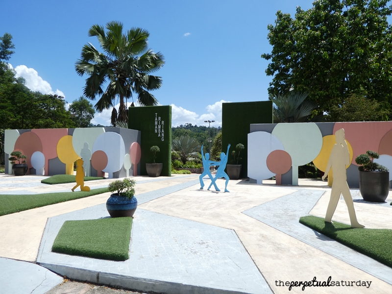
The Harmoni trail begins in the northwestern edge of the forest reserve, off Jalan Rimba Riang 9/1. If you’re using e-hailing, you can set your drop off point at Taman Rimba Riang to give your driver an easy landmark. If you’re driving, you can also park here for free as there seems to be no enforcement.

There is a small shack to the right of the lot with washrooms, but they were closed when we came by. The other toilets are located at the Forestry Information Centre in section 10. There are no public washrooms anywhere on the trail. If you have to go, you’ll be doing it clandestinely somewhere in the bushes, but this is a pretty popular hiking area.
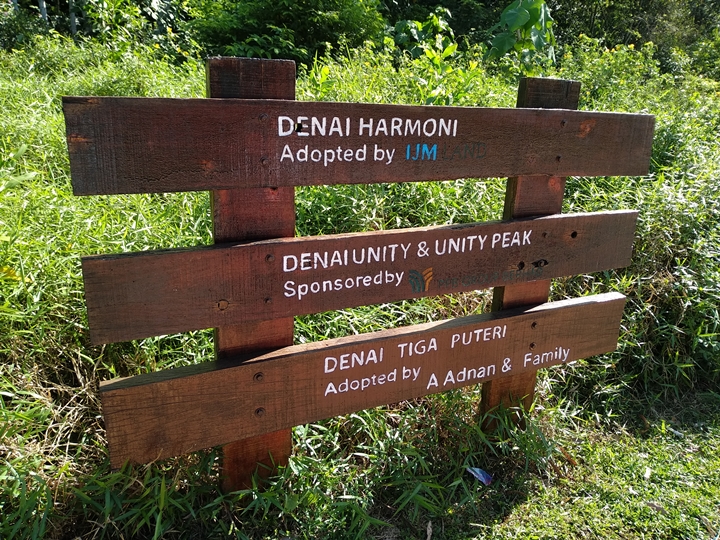
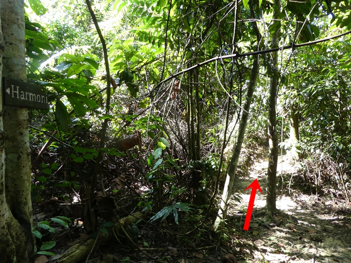
If you’re coming from Taman Rimba Riang, exit the park and turn right to walk along Jalan Rimba Riang 9/1. The entrance to the Harmoni Trail is next to a wooden sign that lists the adopters of certain trails.
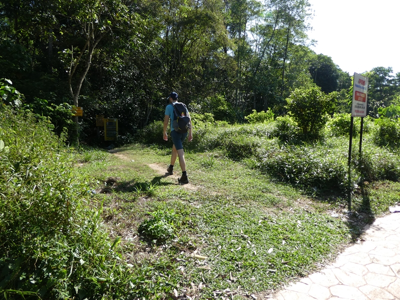
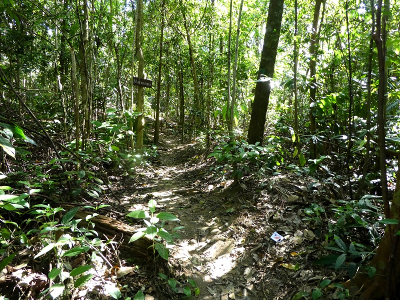
The trail begins level and is very easy. It’s wide and leaves have been more or less swept off to the side so that the path is obvious. Early on, you will get lots of indicators of the trail name (or its symbol, three wavy lines for Harmoni) and a confirmation that the peak is this way.
Rest Areas on Harmoni Trail
The path gets a little narrower as the trail goes parallel to a shallow stream. Cross over the man-made bridge to get to the first rest area of the route.

This rest stop has a couple of picnic benches, but is quite unpleasant. It’s next to the brown rivulet and situated in a dense part of the forest that doesn’t get much sun. At this point, it’s a little too soon to warrant a break unless you’re in abominable shape. Continue onward by finding the path that is to the left of the picnic tables, marked by the Harmoni symbol.
The journey remains flat and unremarkable until about twenty minutes later, where you’ll come to the second rest stop.
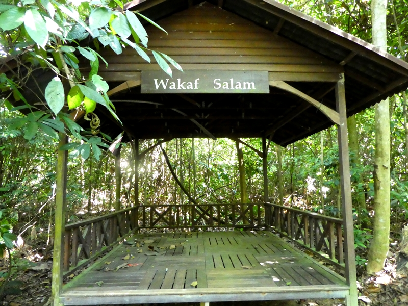
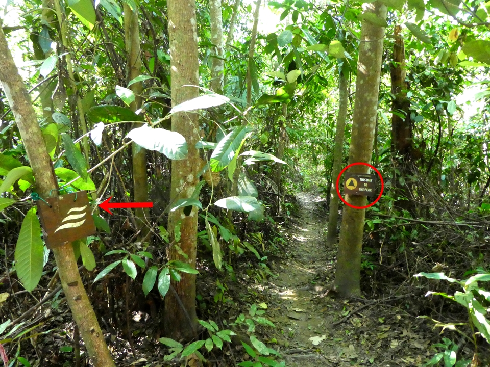
This stop is much nicer with fewer bugs, a covered gazebo and more sun poking through the canopy. When you’re ready to leave, you’ll notice that the Harmoni sign confusingly points left toward the gazebo. We poked around and couldn’t find any visible paths in this direction. You actually want to get on the path that goes off to the right of the sign.

Unity Trail
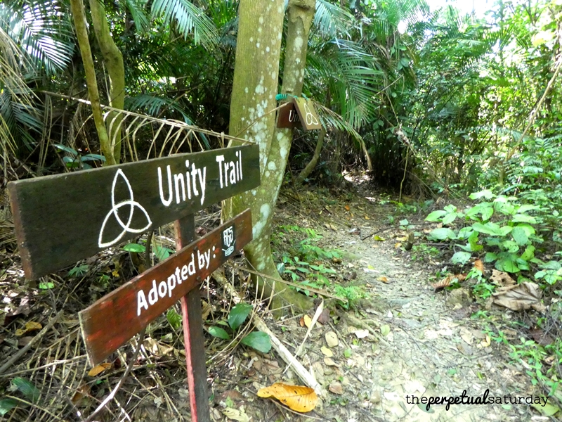
Very soon after this, you will encounter a transition to a new trail path. The Harmoni trail has officially ended and you’ll be on the “Unity” trail for the next little while, also denoted by a trillium symbol.
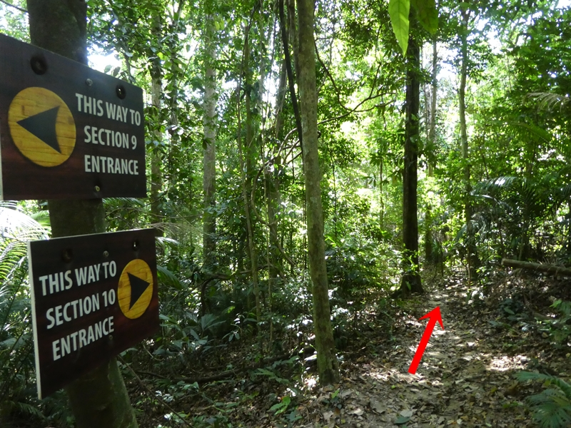
At the bottom of a slope is a post with “Entrance 9” and “Entrance 10” pointing in opposite directions. You want to head in the “10” direction.
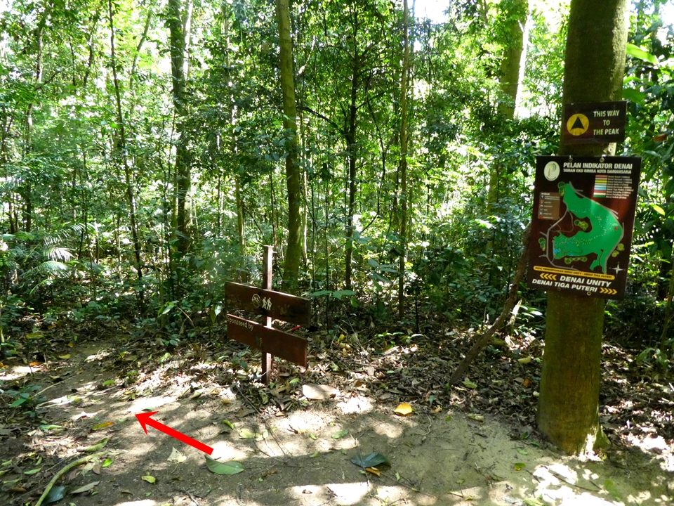
After a couple of minutes, there will be a forest map and a “THIS WAY TO THE PEAK” sign at the end of a path. Turn left at this post, going past the “sponsored by” sign.
Immediately after this, the trail gets more interesting and the difficulty ramps up. Nothing crazy to start: a bit of a drop, increasing frequency of fallen trees blocking the path and a brook crossing that must be done on slightly wobbly rocks… twice!


Soon after the second water crossing, the climbing begins. It’s a moderate ascent requiring big, hoisting steps. If you’re doing this hike with a companion, this is the part where the both of you will stop talking, and will instead be using your mouths to pant for air.


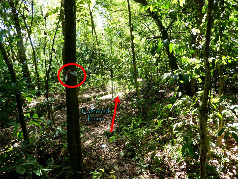
There is a lot more debris on the path up here. You’ll have to keep your eyes peeled for the route markers – red and white caution tape – wrapped around the trees at eye level.

The trail will soon follow a ridge between two valleys. We kept following the striped tape that was on the trees and eventually it brought us back to civilisation: a chain-link fence. There was a portion of the fence that was caved in and flattened. It looked intentional, so we stepped over it onto the other side as the tape marker told us to.
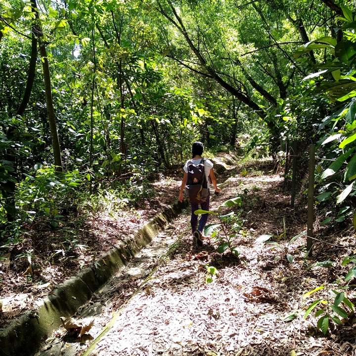
Now you will be following a drainage trench. You can alternate between walking in it or beside the fence, whichever is cleaner and has less overgrowth. You can stray a little further to avoid obstacles, just make sure you’re following the direction the trench goes. We had to cross back over the fence, only to immediately cross back to go around a large tree that had collapsed across the trench.
You’ll be able to hear – or see! – zooming cars by now. The summit is still about fifteen minutes away. There will be what looks like a staircase heading down that will be on your left. Although the trench path is getting more and more overgrown, do not take this downward path. Keep following the trench path, the obstacles will clear up shortly.

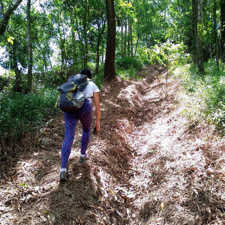
There is a brief, canopy-free space before you’re plunged back into the jungle. The last stretch before the peak is mildly challenging, and not just because you’re tired and sweaty at this stage. There is a steep climb up another storm drainage system, but this one is more of a dirt gully. There are a lot of dead leaves and small twigs to make your footing precarious. If it’s at all damp, taking a tumble is guaranteed. Further on, the grass has encroached back onto the gully, so you can walk on the grass where it’s safer.
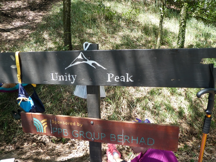
Unity Peak
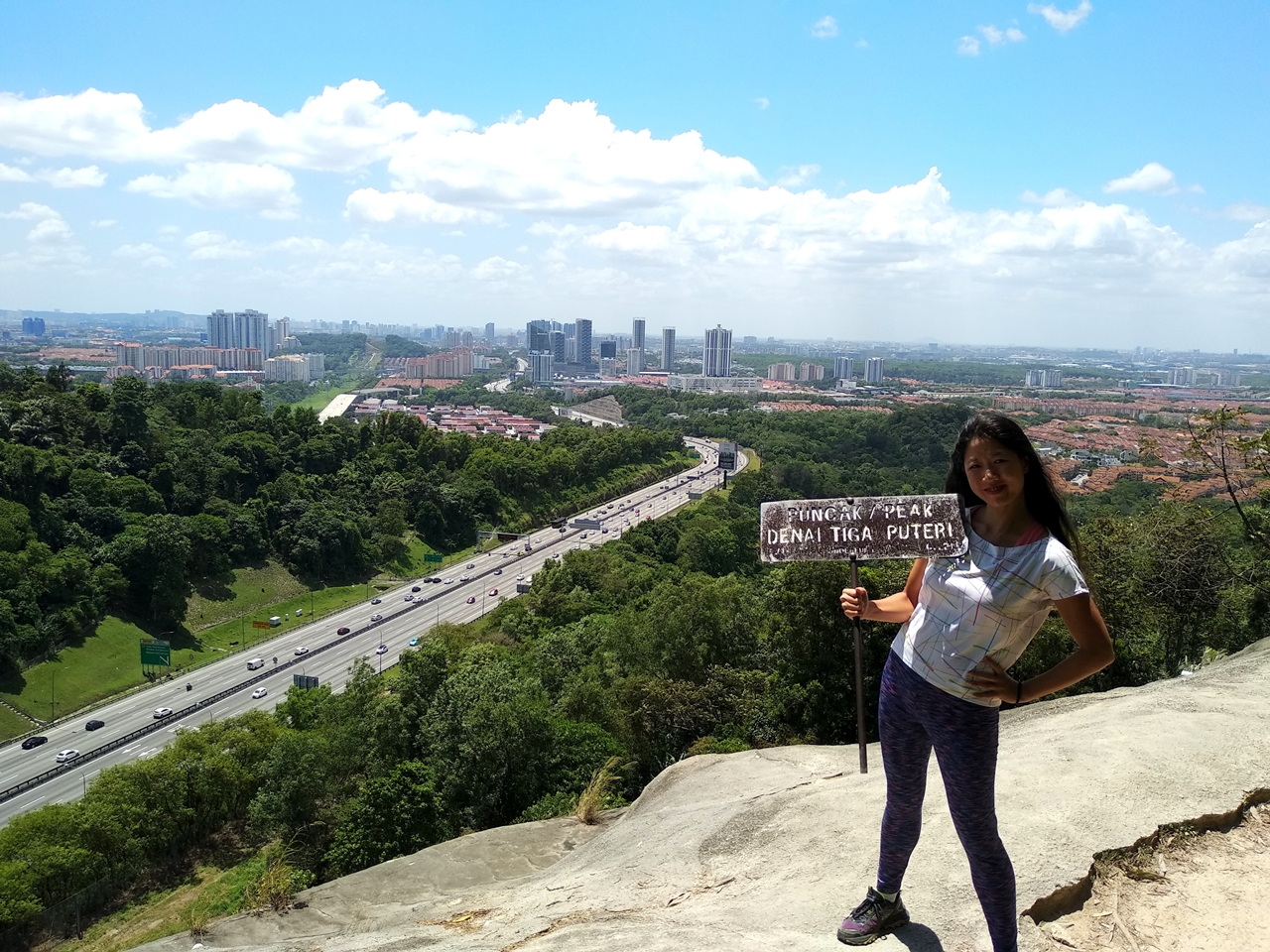
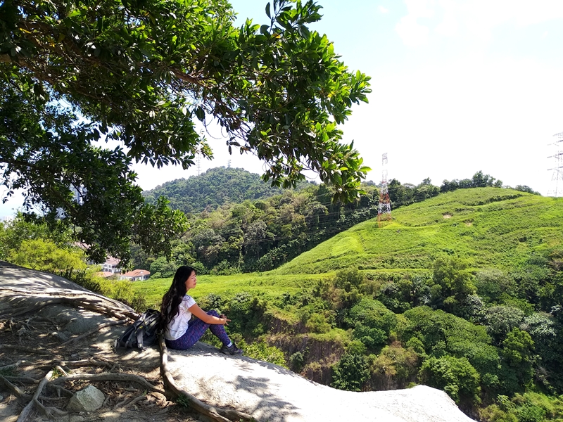
Once you’ve cleared this, you’re at the peak! The first area is decent with a view of mountains and the suburbs in the distance. While we were here, other hikers were claiming the choicest spots: in the shade by the “Unity Peak” sign, and a spot near the edge with a squat rock.
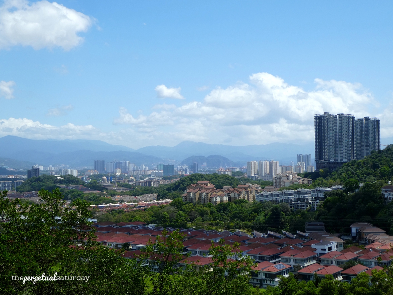
Continuing along the path that leads to the right will take you to the busier and more preferred lookout point. This area will have a view of the highway, condos and deeper into the Kota Damansara neighbourhood. There is a tree that provides the perfect amount of shade for relaxing by the edge facing the highway.
Denai Tiga Puteri Trail
Your route off the peak and out of the Kota Damansara Forest Reserve is up to you. If you need to get back to the start of the Harmoni trail without doing a complete backtrack, take this path to the left of the peak signpost. This is the “Denai Tiga Puteri” trail. It’s a narrow road and you will inevitably encounter hikers on their way to the peak, so yield appropriately.
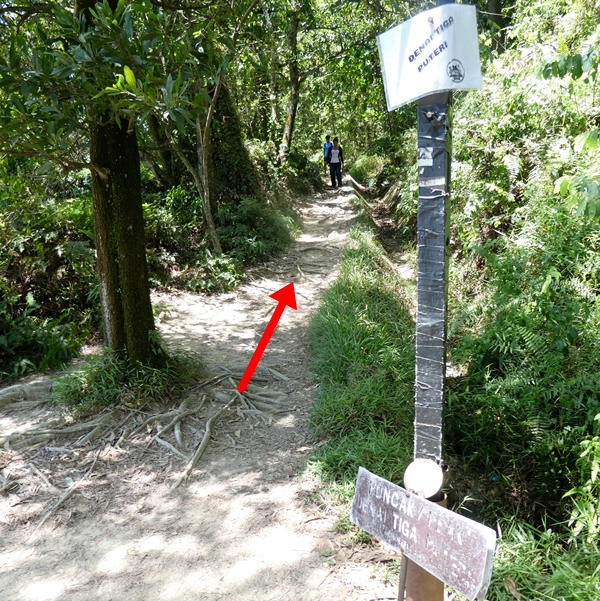
At this fork shown in the photo below, I would advise that you take the left. If you take the right, it will stay flat for a few paces before dropping down steeply. The left has a rather short initial drop followed by a much gentler slope, but the path is very narrow – barely enough for your two feet and sandy as well. Today the sand was bone dry and cascades of pebbles made walking over this a little tricky. This would be a mucky, slippery nightmare if it has recently rained.

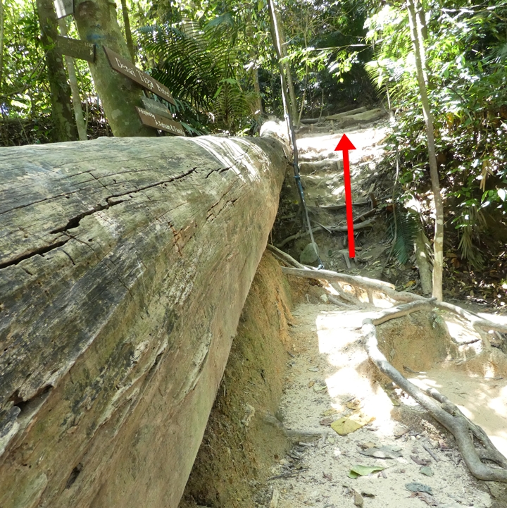
The rest of the way down is foolproof. At first, there will be man-made dirt stairs, but soon all you’ll get are dirt slopes. When you get to this huge fallen log with the trail sign above it, keep to the right of it and go up the small incline.
Eventually you will come to a map where you can see your location at the trail fork (the map will have a big note at the bottom that Puncak Tiga Puteri is 500m away). You will be at the point where you may make your way out via the same Unity/Harmoni trail as before, or try a different route.
Kota Damansara Forest Reserve Harmoni Trail Info
Duration: 3.5 hours roundtrip
Difficulty: Moderate to Hard
Opening Hours: Weekends & Public Holidays 7:30 AM – 2 PM, Monday to Thursday 8 AM – 2 PM, Friday 8 AM – 1 PM
Address: Jalan Rimba Riang 9/1, Seksen 9, Kota Damansara, Petaling Jaya, Selangor 47810
Parking: Yes, at Taman Rimba Riang (possibly free)
Washrooms On Site: Yes