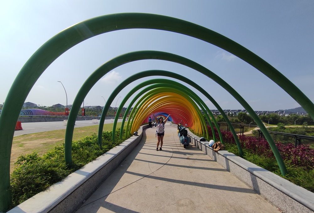

Cheerfully brightening up a concrete overpass, the Rainbow Bridge at Elmina Valley Central Park is KL’s latest Instagram hotspot and the endpoint of a bonus hike you can do from the Bukit Denai Alam trail. Anyone doing the Bukit Denai Alam hike won’t be dressed for a nice picture once they get to the bridge, but the surrounding Elmina Valley Park offers a civilised place to rest and maybe even get some food.
This post is a continuation of my Bukit Denai Alam trail guide. If you want to include this optional scenic route in your Bukit Denai Alam hike, this route will take about one hour roundtrip. Keep in mind that this does not include any time you spend eating or resting. This optional trail begins and ends at the field on the Bukit Denai Alam trail, so you can easily tack it on to your journey if you have the energy. There is also the option to begin a hiking loop from the Rainbow Bridge. You can use this post as a rough guide to do a short walk to the river or the aforementioned field.

The Trail
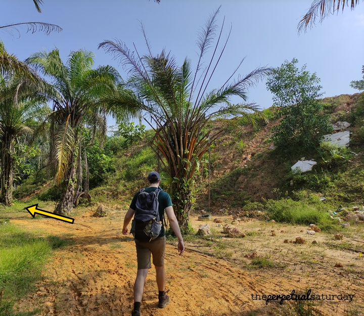
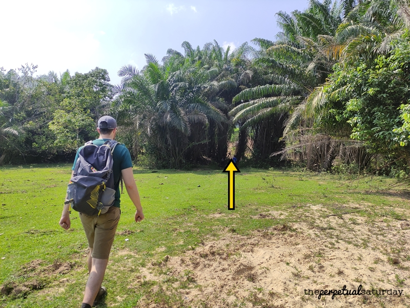
Start at the stream at the edge of the field as outlined in the previous Bukit Denai Alam post. After you’ve crossed the small stream, head in a vaguely left direction as you cut across the field. You should see a short mound of raised earth in front of you that extends for quite a long way. You want to follow this and keep it on your right side until it runs out. Try to find this vague dirt path that leads toward a block of homes in the distance. The path fades and you might lose it, but you’re supposed to hook left through two groups of trees.

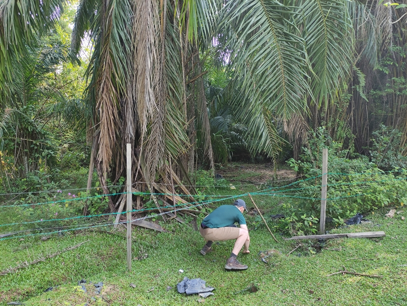
There will be a small clearing and a low barbed-wire fence at the edge of the trees. If you can find this stick propping up the fence on the left side, this is where we re-entered the jungle. It’s unlikely that it will still be here when you hike this trail, but you never know. I don’t think it matters that much if you can’t find it, as I’m pretty sure this patch of the jungle all ends at a footpath between the trees that I describe below.

The trail we took had a lot of dead leaves, but otherwise, it was pretty evident where to go. At this point, the path ahead seems like the more obvious choice if you’re not paying attention, but it looks blocked and overgrown, so you want to turn left.

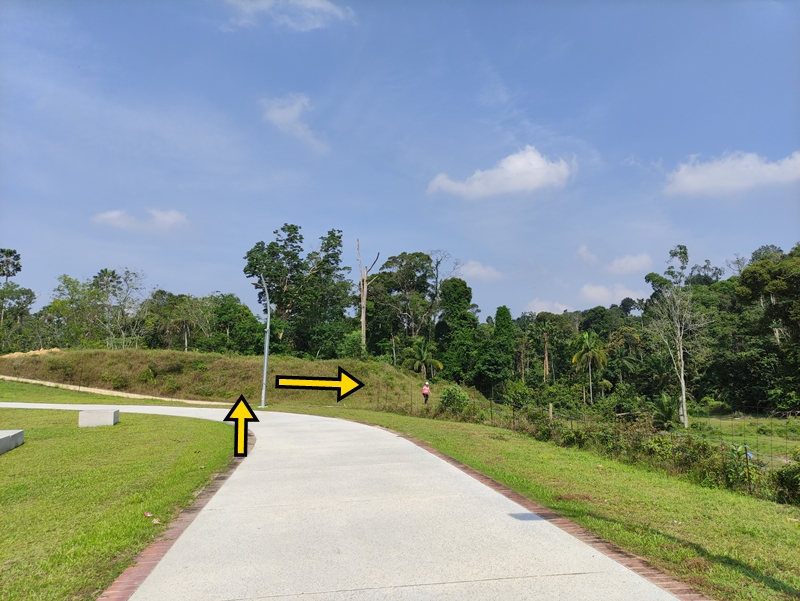
Look for an exit out of the jungle with bright green grass beyond the threshold.

You want to get onto this wide, clear lane that bisects the clumps of forest on either side, and turn left.

It’s about a five-minute walk until you get to a point where the trail splits in two. We continued straight ahead. The path to the right leads away from the destination and was blocked off today anyway.

The trail heads toward a squat ridge before curving left to run parallel to it. Once you get around the ridge, you’ll see the river and the red hills of impending construction beyond.

In front of you, there is a rock bridge that crosses the river. Although it has been made more sturdy with binding metal, there is still some rock balancing involved and you might get your feet wet if you misstep. Once you’ve crossed to the opposite bank, turn right.

A noticeable trodden path has been created by hundreds of feet, which you’ll simply follow for quite a long way.

The trail will slope up over a small hill where you might see great mounds of dirt that look like Stonehenge. In the distance behind this, you get your first glimpse of the Rainbow Bridge.


After passing Dirthenge, the path will curve to the left and eventually become wider and rockier as it inclines sharply up to get up to the road.

Once you crest the hill, it’s a much different landscape up here with fresh concrete sidewalks and endless rows of generic houses. On your right, you’ll see the Rainbow Bridge you’ll be passing through. On the road next to the bridge, there may be a couple of vendors set up depending on the time of day. On this Sunday at 10 am, there was an ice cream cart and someone selling children’s toys like bubble blowers. There is a ledge on either side of the bridge where you can sit and eat if you’d like. For a little more peace, there are places in the park where you can have your snack. Once you’re done here, walk through the Rainbow Bridge.

Once you’ve passed the colourful tunnel, there will be a chill stretch where you’re just walking on the sidewalk next to the road. Go right onto the first turnoff to enter Elmina Valley Central Park. It doesn’t matter which path you take through the park, as long as you head in the direction of the brown roofed building at the far end.

The curvy concrete lanes of Elmina Valley Park are wide and meticulously clean. This park is so brand spanking new that the rubbish bins didn’t even have a liner bag in them yet. There weren’t any benches installed so far that I could see, but you can sit on the ledges off the path.

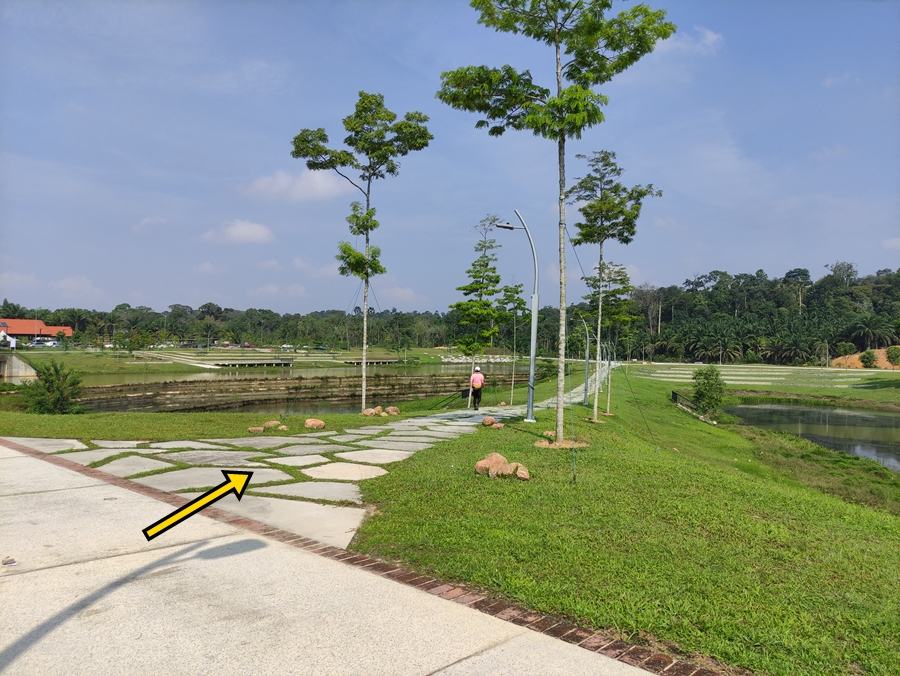
We stayed on the left side of all the park’s ponds and took a left at the fork in the above picture. We walked on a cobblestone path and at the end of it, we turned left to begin heading out of the park.
The path will curve to the left, but you want to look for a break in the shoddy wire fence right at this spot. Go through the break and turn right onto a more simple dirt path.
This will slope back down to the river and a familiar landscape.

At the end of this ramp, turn left and you’ll soon be back at the river’s rock bridge. Retrace your steps so that you are back onto that wide, grassy lane. Re-enter the jungle and use the same route as before to get back to the barbed-wire fence, or explore new paths.

Once you are back in the field, follow the raised mound to where you would leave this field as described in my other post to begin your exit out of Bukit Denai Alam.
Trail Info
Address: Unnamed Road connected to the southern tip of Persiaran Shorea, 47000 Selangor
Opening Hours: Open 24 Hours
Duration: ~1 hour roundtrip
Parking: Yes, on street (free)
Washrooms On Site: No