
Short but steep with an elevation of roughly 240 metres, the Bukit Kembara trail is an easy to moderate hike up the namesake hill. Because there are distinct “parts” to the full trail, this is a nice customisable hike that can take you between 1-3+ hours. You can revisit it multiple times to match your fitness level or schedule for the day. The following is an outline of the first part: the way to the Bukit Kembara summit.
Word of warning: just like many of the other rugged hiking trails in Malaysia, there are no toilets anywhere along the way… aside from the toilet that surrounds us all the time (that is, ducking behind a bush). This hike is on a hill though, so going off the path might be difficult or hazardous. Make sure you go before you get here.
We took a Grabcar and put our destination at the nearby Emerald Hill Condominium to have an easy landmark. There is also visitor parking for the trail at the base of the hill, where Jalan Bukit Indah Hujung and Cangkat Bukit Indah 2 intersect. Though it is a small lot that was quickly filled, Malaysians have the keen ability to create parking spaces where needed. Parking on Cangkat Bukit Indah 2 was inevitable and the accepted lay of the land. Strangely, the entire lot and street were jammed with cars, yet we only encountered two other hikers on the entire trail.

The entrance to the trail is marked by this little shrine. The start of the trail is to the left of it.
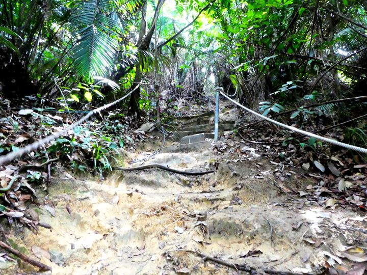
The trail immediately gets going with relatively steep ascents. Rubber hoses and fraying ropes find a second life as trail boundary markers. At times, there will be handy stairs, man-made or the result of thousands of feet stamping the Earth, that make the climb less of a scramble.
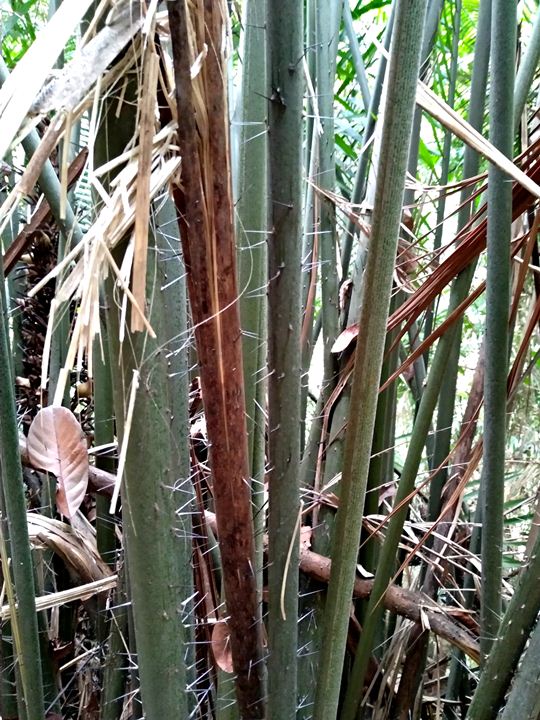
When you’re getting tired, be careful what you grab onto for support! The jungle is rife with these spiky trees that are seemingly trolling you throughout the hike. They pop up at convenient places where you would want to grab onto a tree to pull yourself up the last step to a crest. We even encountered some that were at head level. Well, head level for a Malaysian Hodor. If you’re tall (all five of you), let’s say over 185cm, be vigilant of where you’re walking and be ready to duck low and cautiously.
After a small climb, the path flattens out to give you a short break. It’s short-lived and shoots back upward again.


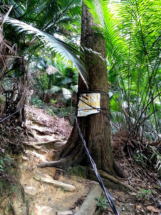
After a bout of more climbing, you will come across this marked tree. Keep to the left of it, as the right is covered in deadfall.
Bukit Kembara seems to be keenly aware of paltry human fitness and will bless you with flat, easy paths after strenuous climbs. There will even be this rock at this point that you can sit on, but look out for crawly bugs on it.

Shortly after leaving the resting rock, you will encounter this slightly confusing situation. The path goes to the left and also straight ahead. We debated the correct way for about a minute before determining that left must be the proper trail. Look closely and you’ll see ‘fragile’ tape on the closest tree. This same marker is on the further tree where the rope is tied.
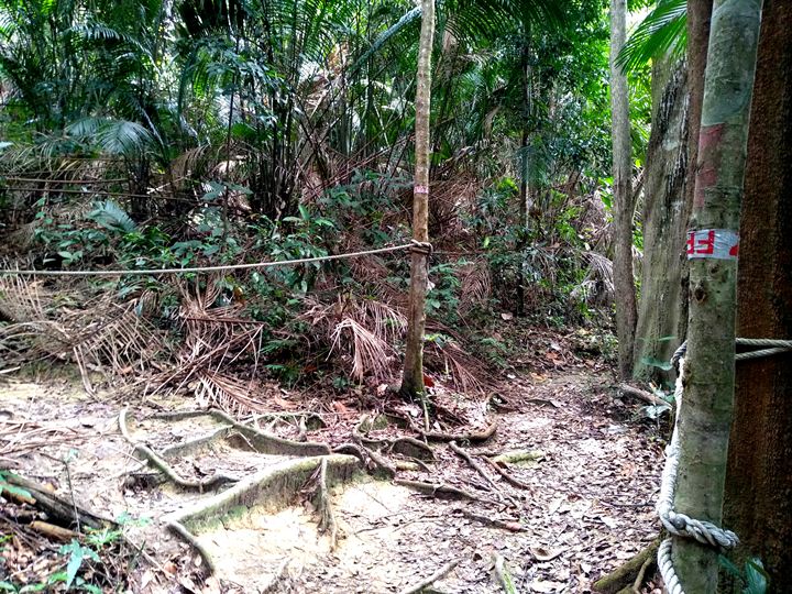
Unfortunately, this was not the end of our “which way?” dilemmas. There will be this ‘tree roundabout’ where one path seems to go deeper into the forest and the other hugs the edge. We took the left with no real reason other than it looked better.
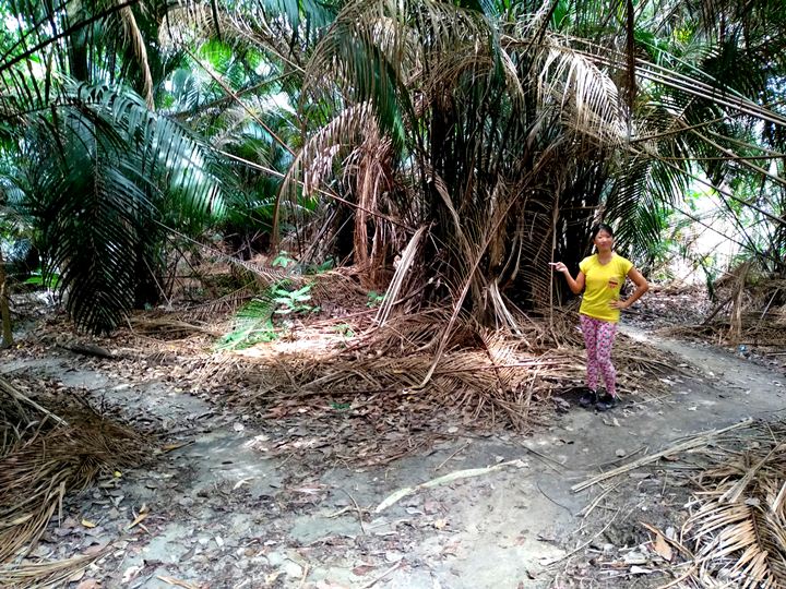
At a cluster of trees shortly thereafter, our path converged with another path from the right-hand side. We started to think that it didn’t matter which path was taken at the tree roundabout. This is unconfirmed as we didn’t backtrack to the roundabout to try, but both paths might just end up at the same singular path eventually.
Before we knew it, we were almost at the top. No longer at eye level was endless stretches of green. We saw the summit from below before reaching it: a perfect glowing window of white sky between dirt and dense foliage.
At the top of Bukit Kembara, the growth is so thick that there are no views to be had at the summit plateau. Some ramshackle benches and tables have been fashioned for hikers to have a rest, a snack, and pat themselves on their sweaty backs.
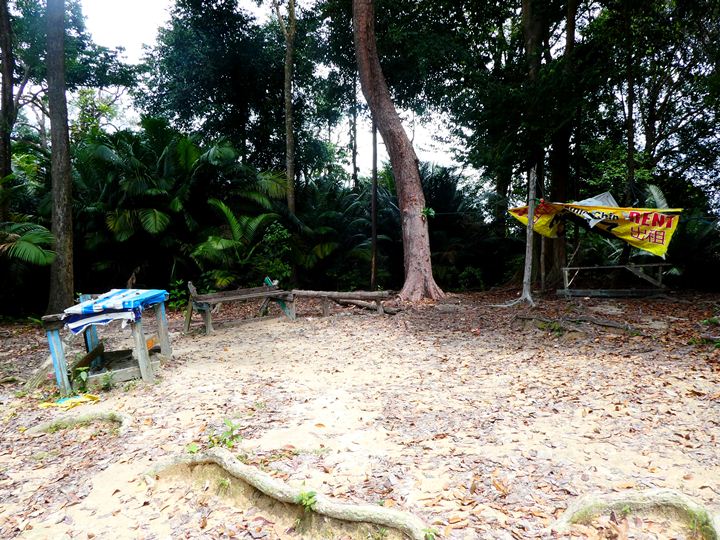
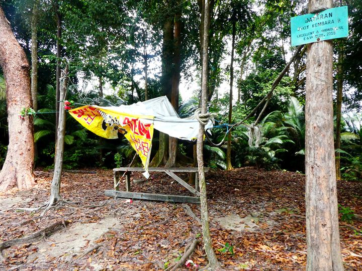
It’s hot. You’re smelly (no judgment). You’ve got air-conditioned places to be, preferably with food. If you’re looking for a casual, hour-long hike for your morning or evening constitutional, this summit is the point where you turn around and go back the way you came. You will leave Bukit Kembara the same way you entered it at the shrine. Those with a more adventurous spirit and a couple more hours to spare can continue to the Ampang reservoir.
My next post will go into detail on what to expect on the way to the reservoir, as well as how to escape the Bukit Kembara nature area with no backtracking. A razor wire fence blocks off an exit, so it’s a dangerous journey not for the timid!
Trail Info
Address: Ulu Kelang, 68000 Ampang Jaya, Selangor
Open 24 hours
Duration: 1 hour
Parking: Yes
Washroom On Site: No




Comment on “Hike to Bukit Kembara Summit”