It’s a story as old as time by this point: yet another hiking area in KL is being destroyed for the sake of development. The Bukit Denai Alam Trail is the latest casualty to be caught in the wormy grasp of developers. Soon the DASH highway will plough through the area, so the time to hike through this palm oil plantation is now.
This hike should take about two and a half hours, and there are no toilets anywhere on the trail. This is an easy hike with no rough terrain involved, aside from shallow stream crossings. The trail is flat with wide, clear paths for most of the way. There are no steep climbs, in fact, there is barely any slope to the terrain. Despite the lack of challenge for serious hikers, the Bukit Denai Alam hike has gorgeous views of the lake and scenic paths through rows of perfectly spaced palm trees.
Location & Parking
The Bukit Denai Alam Trailhead is located at the very end of Persiaran Neutron at its southern tip.
There is no official parking lot for visitors to the Bukit Denai Alam Trail, but everyone parked on the street as close to the trail entrance as they could. Since there is no official lot with enforcement, parking is free.
We took a Grab here. Getting here was easy as the trailhead is an actual marker on Google maps. While we were concerned about getting picked up in this semi-remote location, we found a driver after the second try. The only issue was that it took them a while (under ten minutes) to get to us. There is a bus shelter that you can wait in if you are similarly waiting for a ride.
The Trail
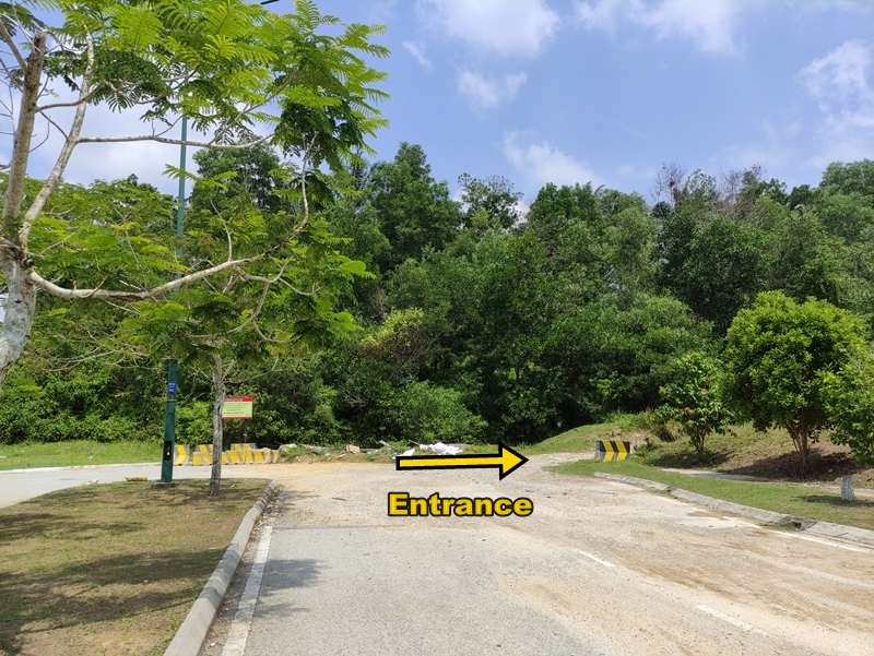
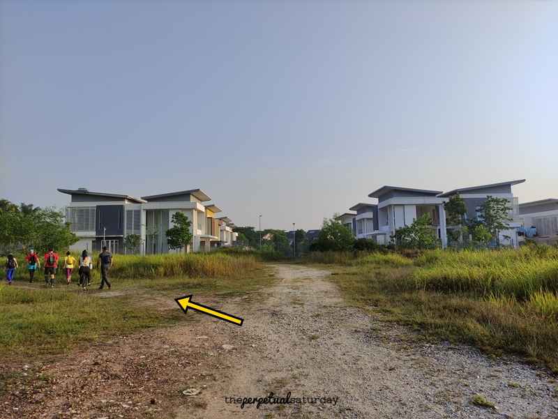
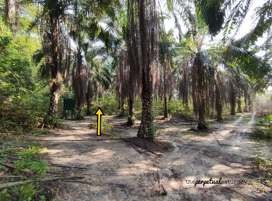
The entrance to the trail is at the end of the street on the right side. At first, you’ll be walking toward those cookie-cutter houses directly ahead, but there will be a path that forks off to the left. Take this to walk alongside the fence behind the houses.
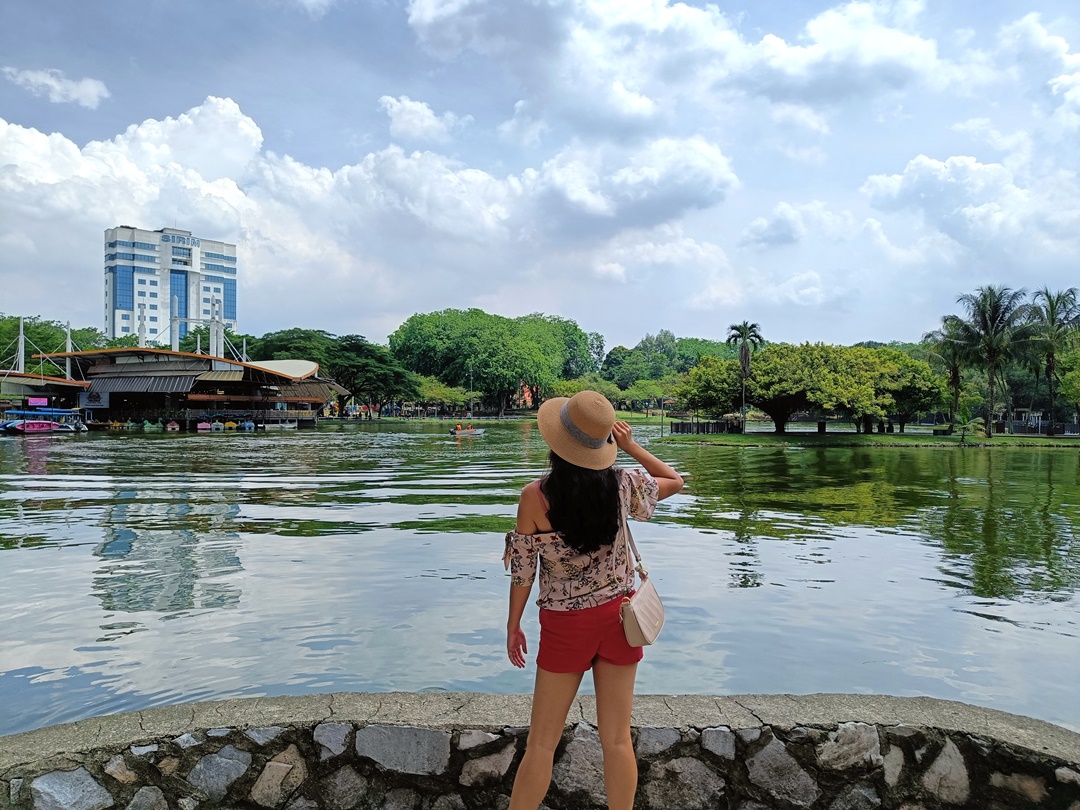
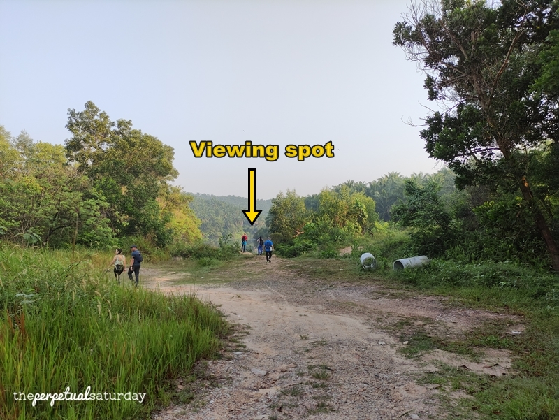
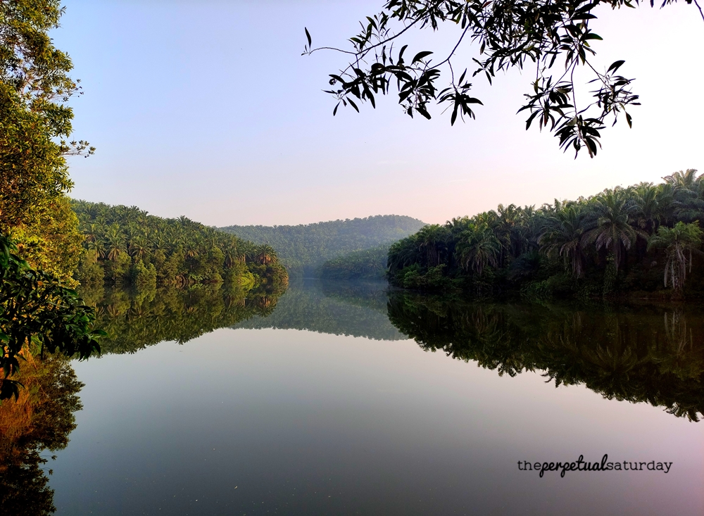
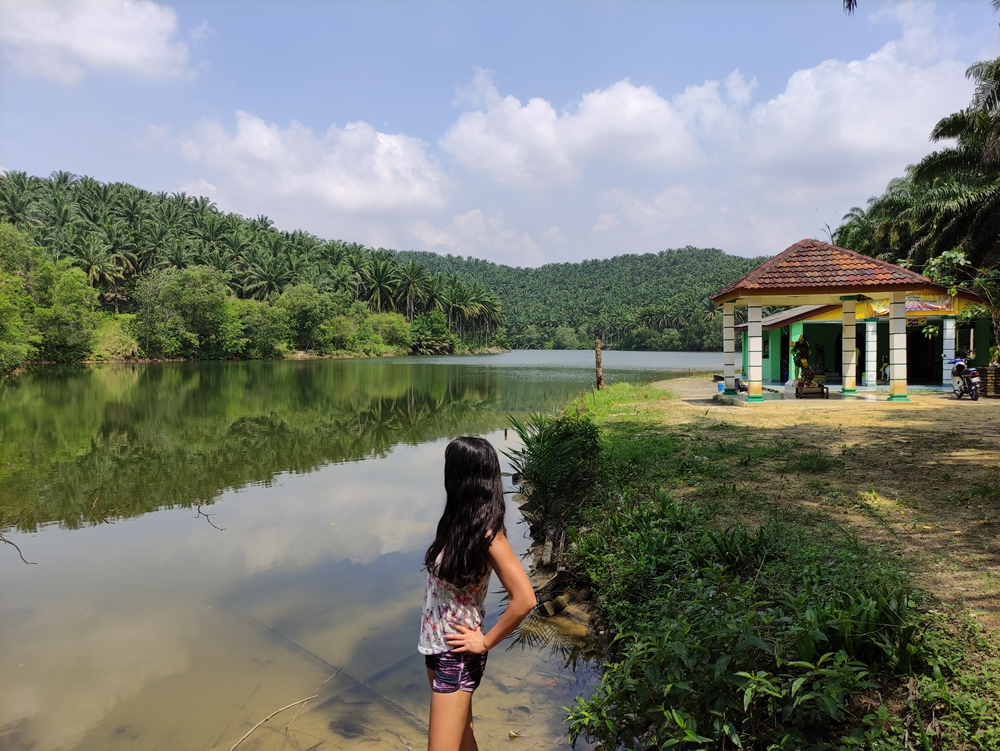
Shortly, you’ll get to a spot where there’s a small break in the trees and you can overlook the lake. Take a peek, but don’t spend too much time here taking photos and selfies. Around the corner is the next viewing spot, and it is much more picturesque since the trees aren’t blocking the view as much. I’m not sure if this lake even has an official name – Google gives it the unsexy name of “AMMJB TJL 775 Lake” – but it is surprisingly clean and debris-free. On a quiet, still morning such as this, the lake is very reflective. Its mirror-like quality is better than some of those so-called “mirror lakes” that are tourist attractions. A little bit further is a third viewing spot slightly off the path, but this isn’t very nice as there is an ugly green building on the other side of the lake that will mar your photos.
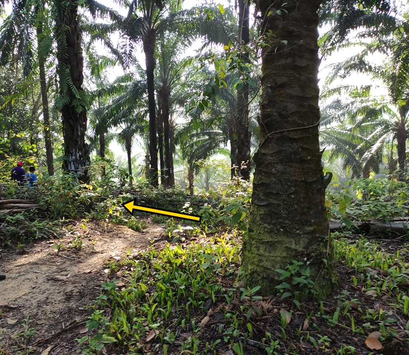
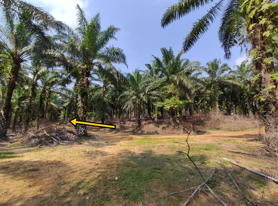
The trail skirting the lake is barely uphill, and at this early point of the hike, you shouldn’t get tired at all. You may notice this fork on the path, but keep left.
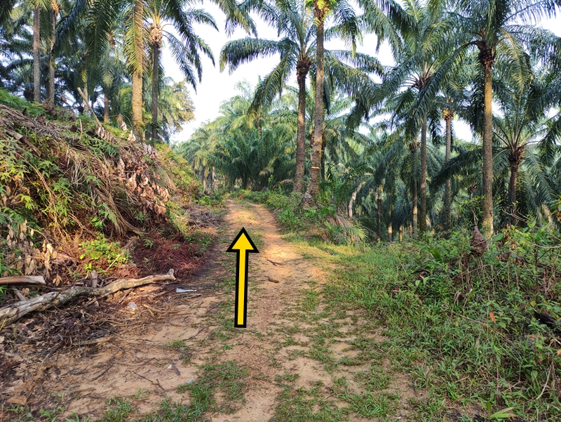
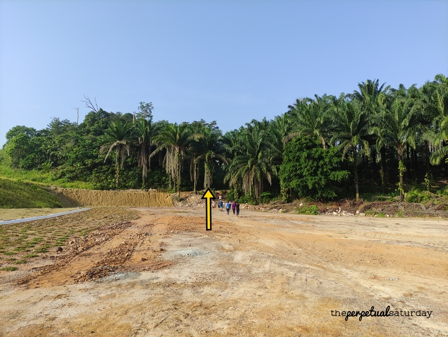
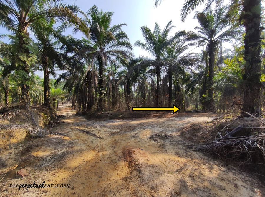
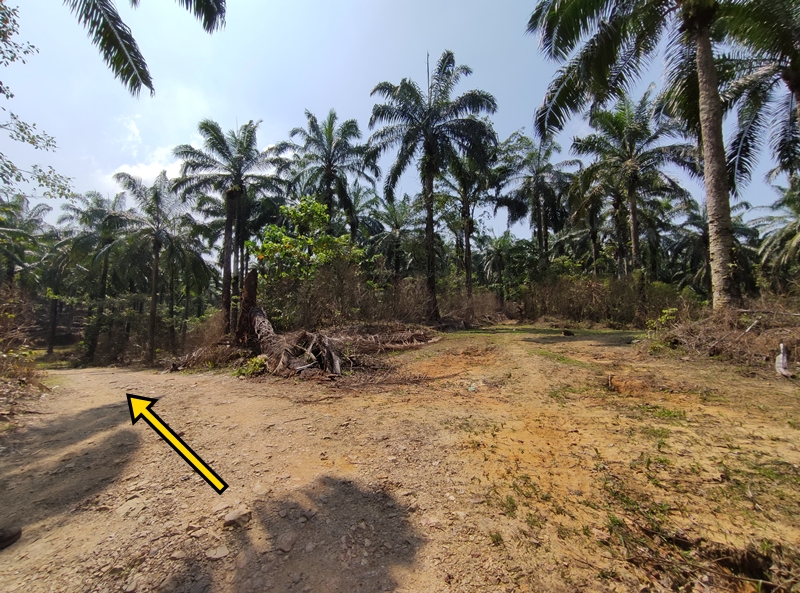
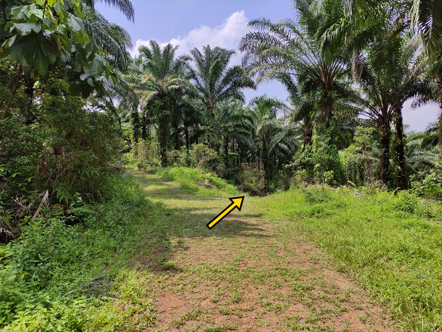
You will eventually come to a junction with three possible paths ahead of you. Take the hard left trail, and on your right, you should begin to see a wide, cleared land – the beginning of the dreaded development that will close this hiking trail for good one day. Keep your eyes open for a fork, whereby you’ll want to turn right so that you’re approaching the developing land.
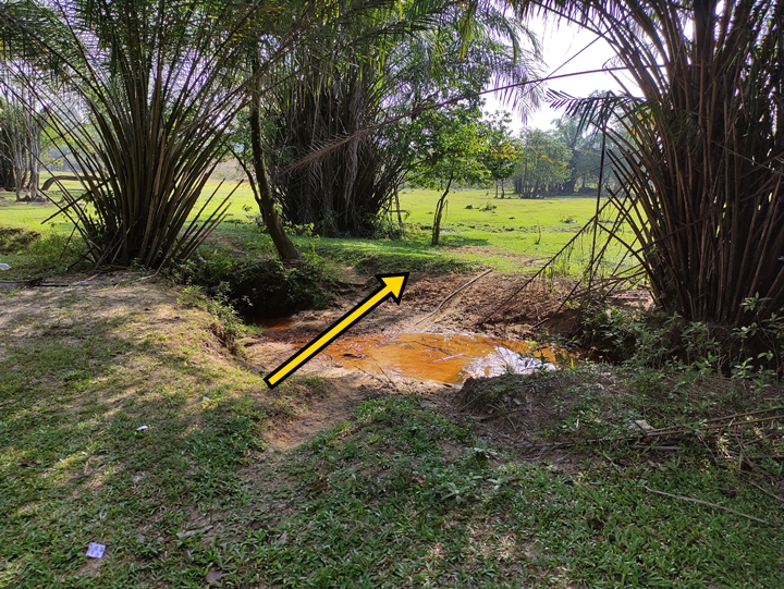
Soon you’re out of the jungle with a little trench separating you from the higher cleared land. Depending on recent rains, there may be a mucky river flowing through this trench. It’s not that wide and can be easily hopped over, or you can use any of the refuse lying around (like rubber tires) to craft a makeshift bridge for you to cross. Once across, you want to head straight and toward the left. There is that green, raised patch of land – you need to go around this to find the way back into the jungle and back on the hiking trail.
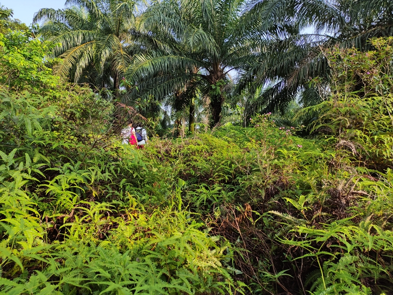
A more adventurous route involves walking on narrow ledges above the water. Keep walking beside the trench until it eventually turns into a small pond. The path hugs the pond until it eventually runs out and you must get on a raised natural ledge to avoid getting your feet wet. This isn’t too difficult, and there were children on the trail doing this alternate route. After you get up on the ledge, you will have to trek through chest-height shrubs for a short distance. Walking along the sloped edge of the pond continues until you’ve rounded the curve at the far end. The ledge walking ends with a slight drop. Slide down on your butt, or try to spot the path just to the left that is gentle enough to take careful steps down.


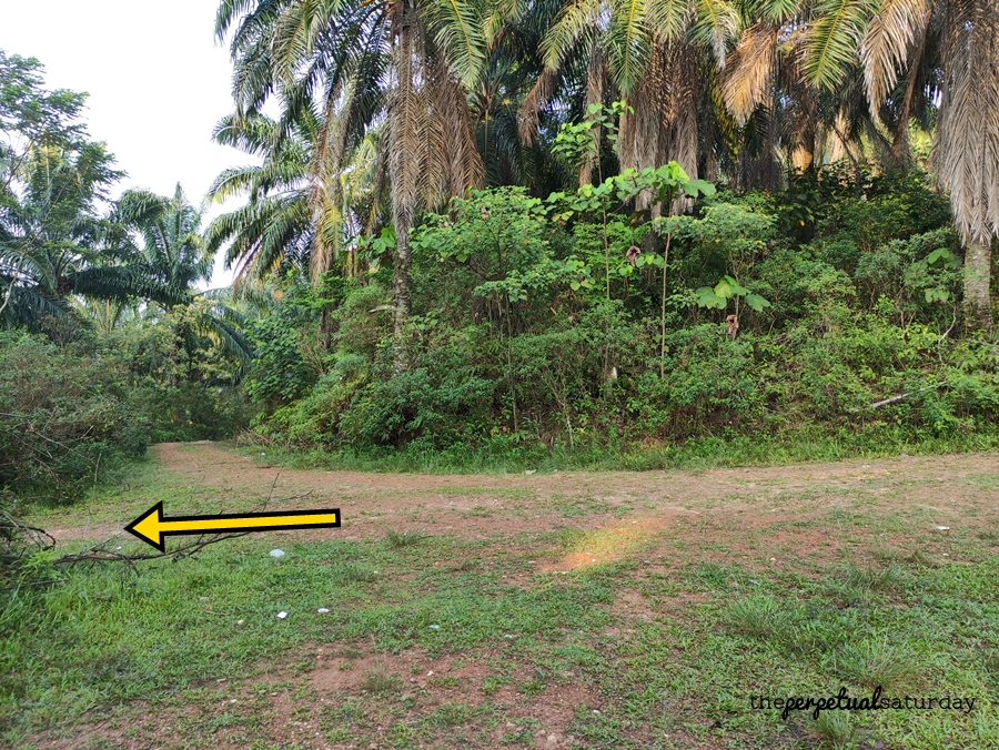
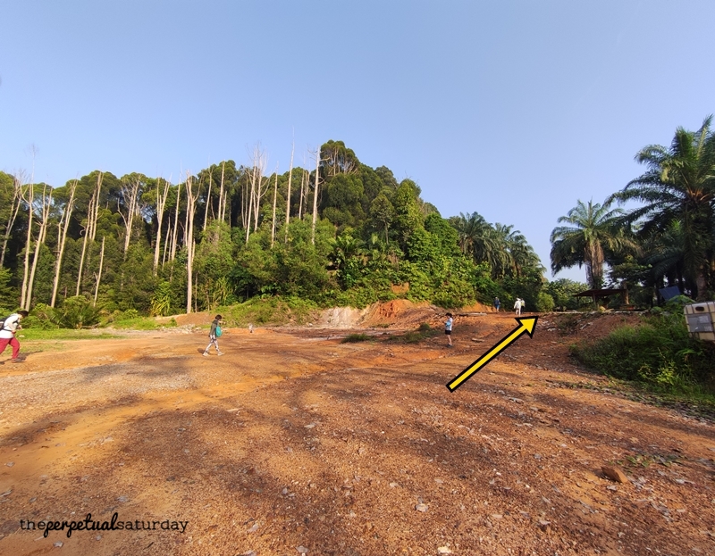
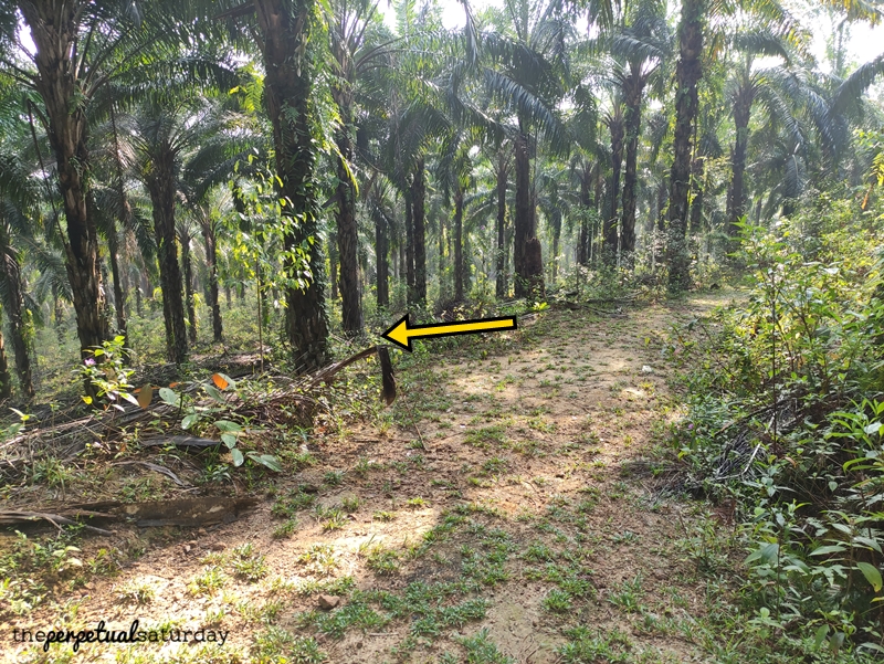
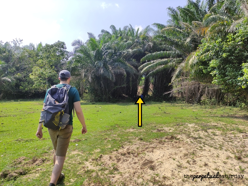
After you’ve made it down, there are some more shrubs but there is a wider path between them. Plod through these until you’ve passed the pond and can step onto the flat developed land. Keep the jungle on your right side to go around the forest. In front of you, you should see a green hill on the left side. You want to walk towards it and turn left once you’ve cleared it so that you have the trail re-entry point ahead of you.
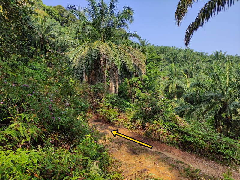
Once you’ve entered the treeline, the trail is straight ahead and easy to follow. Eventually, you’ll come to a wide-open clearing. Turn right up onto the gentle hill where there is a shrine under a tin roof.
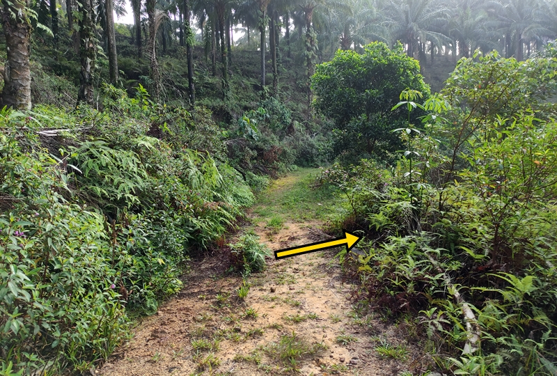
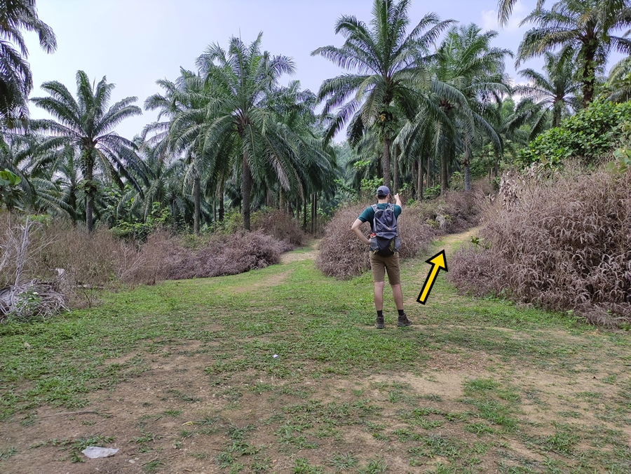
Keep vigilant for this fork where you’ll want to go on the less obvious leftmost path. It gets a little tight and overgrown, but you should be able to spot the human-sized gap in the bushes where you’re supposed to go. The trail opens up more and more until it is a well-worn trench that looks like two lanes – turn left onto this thick path.

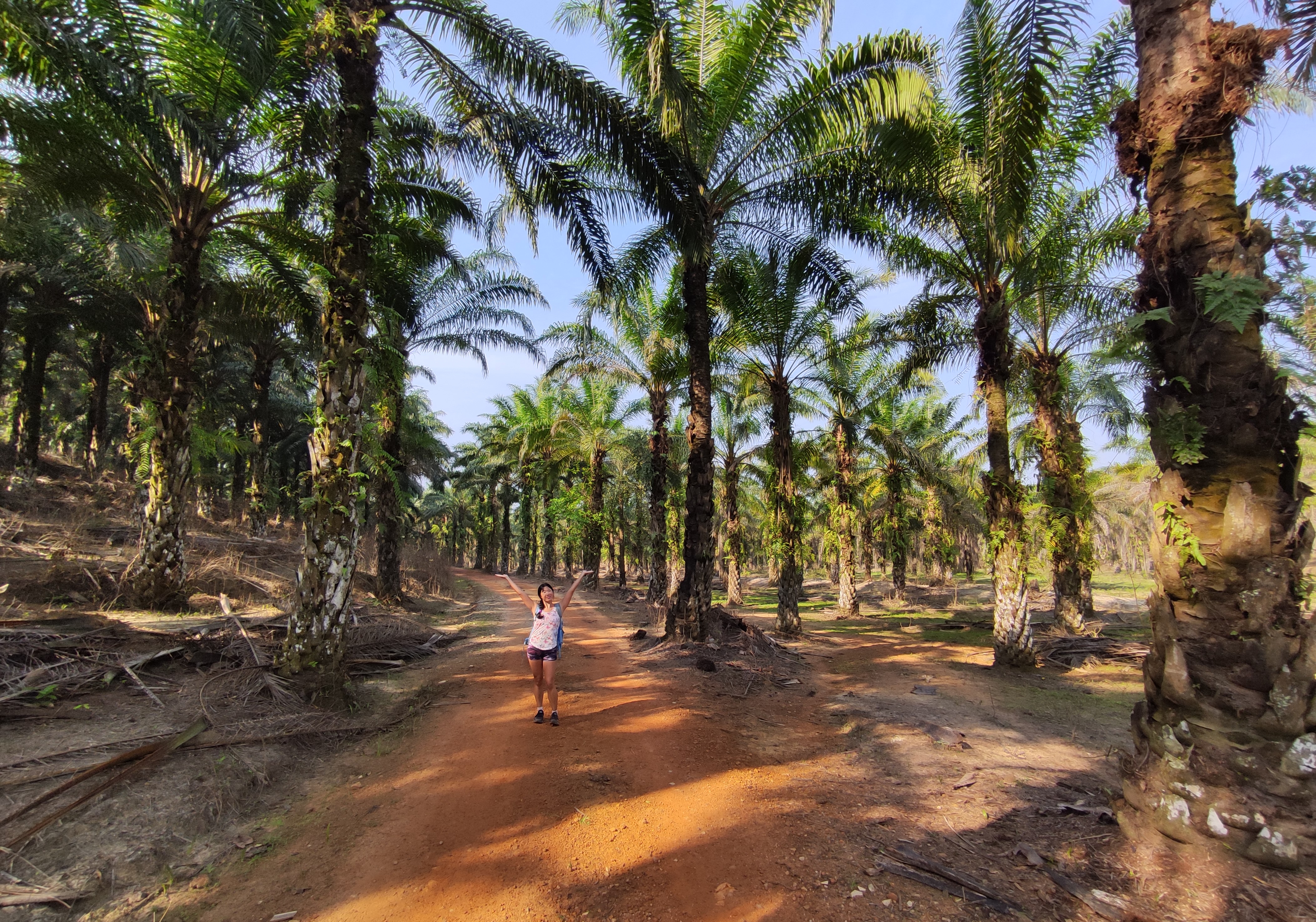
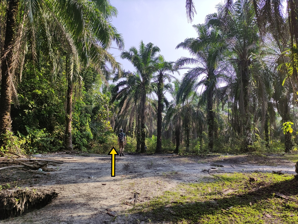
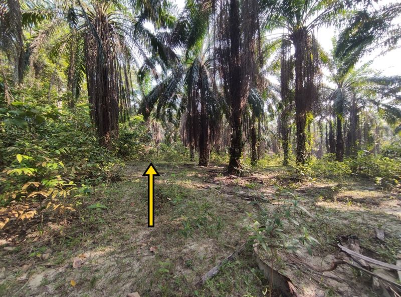
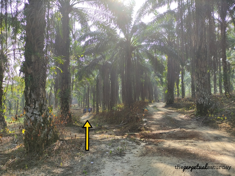
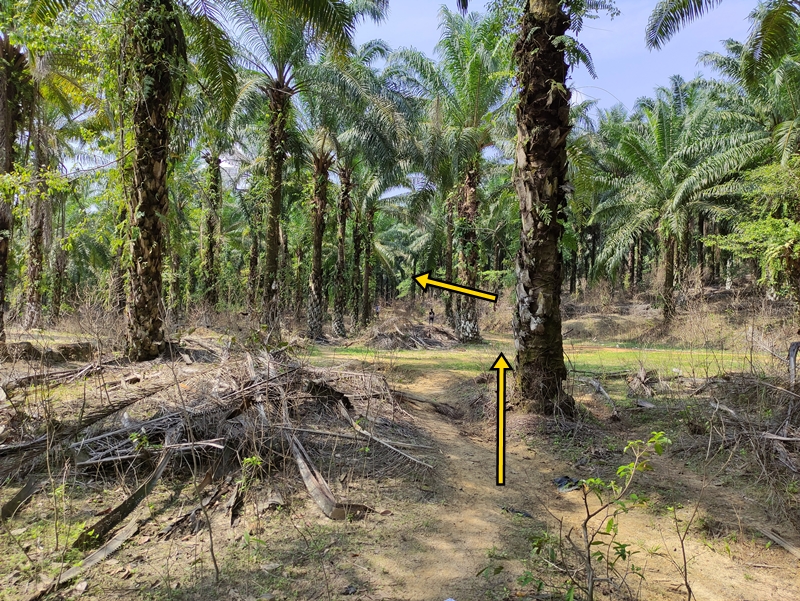
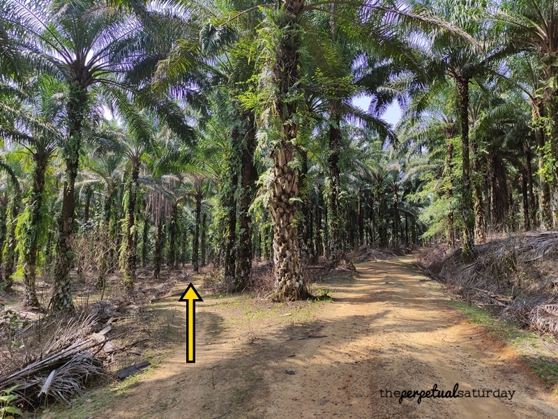
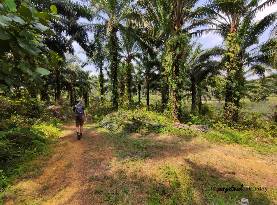
For now, stay on the thicker, more conspicuous path if you encounter any forks. The secondary paths in the next couple of forks will always be less distinct, so you don’t need to watch too closely. At this higher vantage point, your eyes will be better off admiring the palm trees neatly spaced apart on the sloping hill.

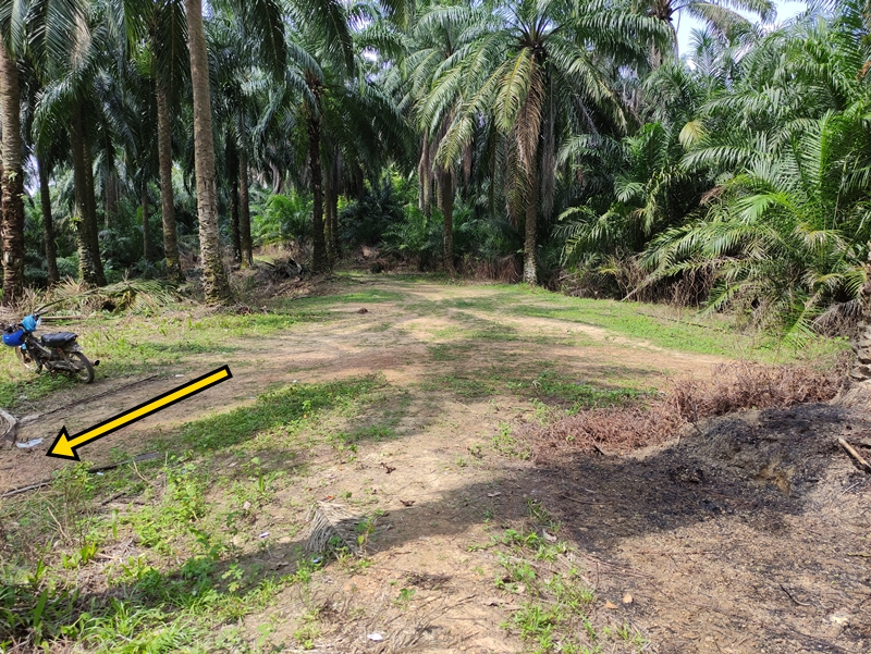
Again there will be another clearing with a shelter directly in front of you. On your right, you’ll see two trails next to each other. Take the one on the left. After about five minutes, you’ll see the edge of the hill in front of you and you won’t be able to go further, at which point you’ll turn left.
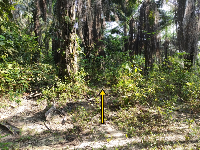
There is much more deadfall here than the paths before, so keep your eye on the trail to make sure you don’t stray off it. Very soon (within one minute) the path should curve left to go gently downward, before opening into a more clear, manageable trail.

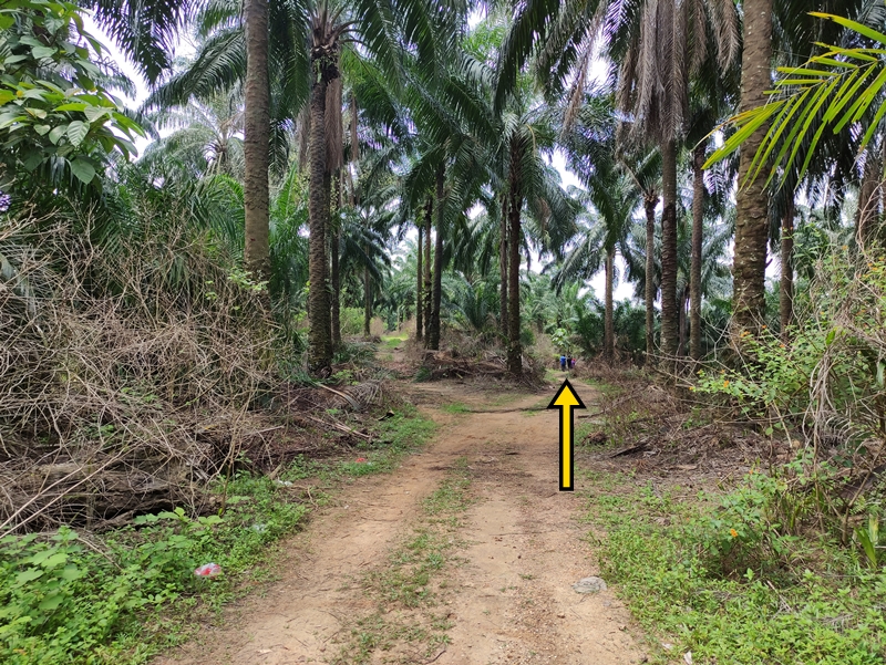
Keep a watchful eye for a path on your left that is easy to miss. Take it, and you’ll know it’s the right way if within a minute you come across palm trees in a clearing on your right side.
Keep going, and take the path straight ahead at the next clearing where several paths intersect.
The path slopes down into a small rivulet crossing. This one looks a tad too wide for most people to jump over safely. If you aren’t wearing water shoes, try piling up the fallen branches (there are many in the vicinity) as a log bridge. Such ramshackle constructions are often rickety, so you should also be prepared for at least one wet sock and shoe.

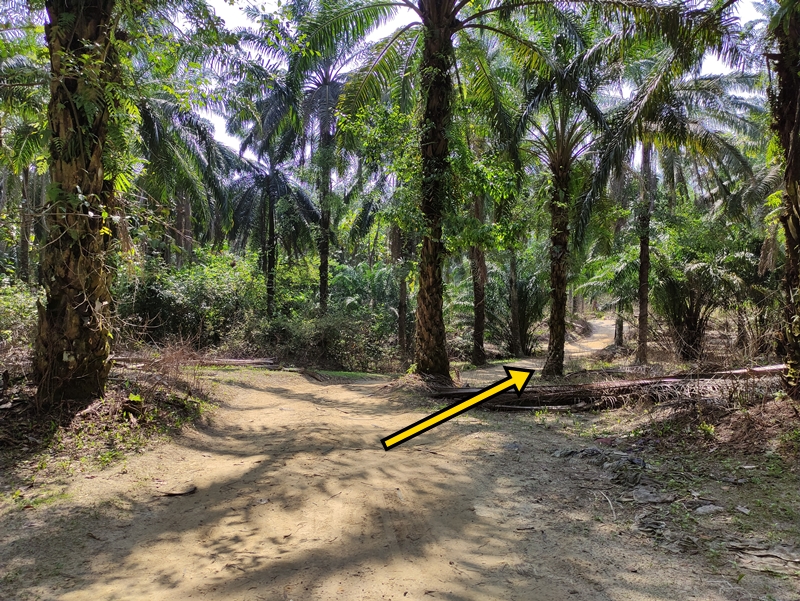
Once you’re over the rivulet, head right. Keep on the left path if you notice any forks. You’ll come to this area with a green metal thing on the left that looks like a giant bassinet. Keep going straight to pass by it and back onto the trail.
At this point where the ground is well-trodden in all different places, you want to take the middle trail. You’ll get to a patch where the trees open up slightly and you should keep left.
The path you’re on will intersect with another but continue straight.

At this small clearing, go on this left path. The trail should become more foolproof after this, with a wide lane bisecting the trees.
A path will open up on your right – take it.
After which there will be a fork where you should take the left one.
Now it’s feeling like you’re properly walking through a plantation with the palms neatly lined up all around you. Follow the trail as it curves gently to the right. You want to find this wide path that will be on your left that heads toward the hill. While on this path, there should be shallow rivers and pool that you pass. Turn left at the end of this path.

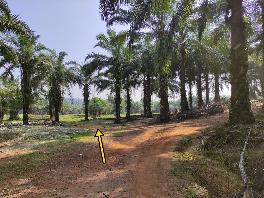
Within five minutes you’ll notice the trail sloping upward to the right with a green field directly ahead of you through the trees. Avoid the upward trail and take this one on the left, which will eventually dump you in the field.
Once on the plains, the treeline that you see directly ahead will have a small stream just beyond it. It’s very narrow and easy to step over. Once you’ve crossed the stream, turn right if you want to begin heading back to the start point of the hike. If you want to do the Rainbow Bridge loop, you’ll be heading in more of a left direction, across the field.
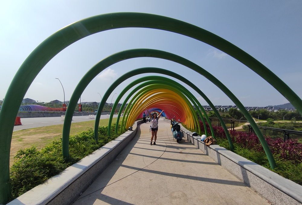
There is an optional leg to this hike which will take you all the way to the Elmina Valley Rainbow Bridge and through the nearby park. The bridge is deep in the heart of suburbia, so it’s not very “naturey” if you’re desperate for that sort of thing. The park looks brand new, so it is pleasant, clean and easy to walk around in. If you’ve brought a packed lunch, this area would be an excellent place to eat it as there are places to sit and sometimes there is an ice cream vendor next to the bridge. The journey to get here is not strenuous, but it is at least an hour roundtrip and will involve ducking under a barbed-wire fence. This optional leg begins and ends in this field, so you can easily decide whether you want to do it based on how you feel at this point. Check out my post Hike from Bukit Denai Alam to Elmina Valley Rainbow Bridge to guide you on how to get there and back.
This field didn’t have anything in the way of benches, tables or anywhere to make yourself comfortable that I saw, but this is a good place as any to rest. After what has been well over an hour of hiking, you can regain your energy in the shade of any of the palm trees around.
If you are keen to begin heading out, take the directions I mentioned above (turning right after crossing the stream). Follow the stream and treeline until you come to a small grove with a smaller gap through it.
Afterwards, take a windy path that curves slightly to the left and cuts through a perpendicular path.
At this junction with a wide reddish path cutting in front of you, turn left to get on it.
At this fork, you’ll want to take the less used left trail. At the next one, take a left again.

The trail branches off into two, and this time, take a right. You’ll know you’re on the correct path if very soon you come to this natural earth bridge over a deep trench.
Notice how the grass is beginning to grow back on one of the paths here. Take a left onto the more trodden path.
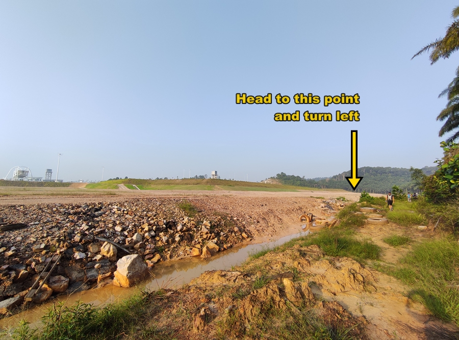
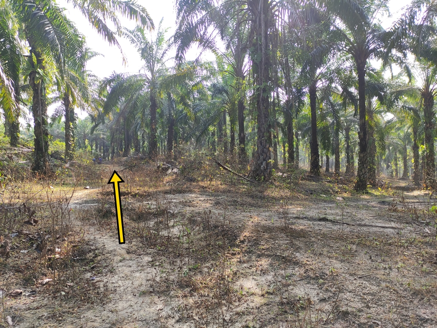
Soon you’ll see the forest end, and maybe even evidence of construction work ahead. There is a turn off on the right just before this that you should take. Stay on the wider main path if you notice any branching trails. Whether it was because I had been hiking for three hours at this point or the hill was steeper than it looked, but I remember being tired and huffing during this stretch.

At this clearing with two visible paths ahead of you, take the one on the right. The trail becomes narrower but is relatively free of debris and easily spottable. Stay on the worn path if you notice any trails splitting off.
At this somewhat circular glade, you want to take a sharp left so that you’re on the path that is running parallel to the trail you just came down on. There were a lot of chopped off palm leaves lying around the area today, which might signal that you’re in the same place. This was also the point where we began seeing locals just hanging out. If it’s the weekend, you may notice their motorcycles parked here and a bit further down.
The path is obvious for quite a while, with a hill on your left and a sloping cliff on your right. There is no confusion on where to go until you get to this fork, where you should take the right path.

Immediately after, the trail will split in two. Take the right again.
Keep going straight along the trail for about five minutes. You might notice your surroundings looking greener and the trail has a little more grass on it. Keep your eye out for this subtle divergent path that is easy to miss.
After a minute or two, you should see a lake beyond the trees on your right. This is the lake from way back at the beginning of the trail with all the picture spots, but we are now on the opposite shore. This side of the lake has more makeshift structures built along the coast which will obstruct your view and ruin any pictures. You’ll pass by that ugly seafoam green building you saw from the opposite side hours ago, which is a small Hindu temple. Ironically, next to this unsightly structure is the only place where you can get a half-decent picture of the lake from this side. People were praying and minding the temple today, so be considerate.
The trail curves around the lake and dips close to the water’s edge. Off on your right will be a very small muddy shore where you can stand and look. Once you’re done, continue on the path to find the way out.

You’ll pass through this clearing where, most likely, there will be several cars parked as well as two paths to take. You want to take this path on the left that slopes upward. This will take you back behind the houses, and once you round the corner, you will see the gravel path that you started this hike on. Head right to get back to the trail entrance/exit and Persiaran Neutron.
Trail Info
Address: End of Persiaran Neutron, Denai Alam, 40150 Shah Alam, Selangor
Opening Hours: Open 24 Hours
Duration: 2.5+ hours roundtrip
Parking: Yes, on street (free)
Washrooms On Site: No