The Salleh Trail follows the curve of the southwestern lake at Taman Eko Rimba Kota Damansara. It is an easy hike with minimal elevation. The route is 0.83 kilometres long, which will take most people 30 minutes or less to complete as a one-way trek.
How to Get to Salleh Trail
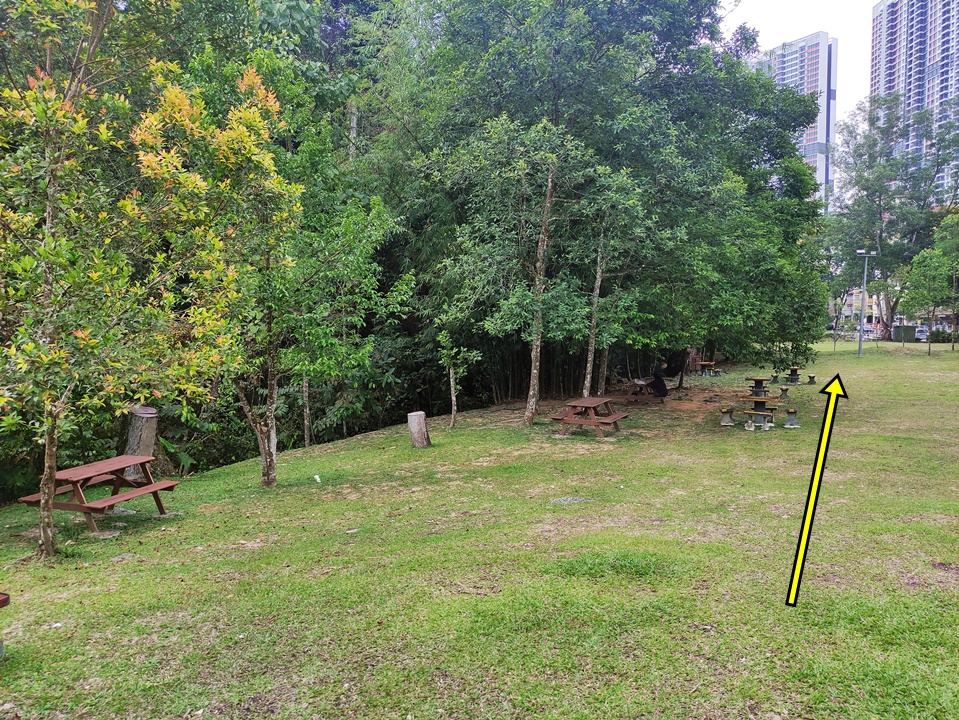
The start of the Salleh Trail is a bit south of the ticketing building. Once you’ve gotten your tickets, head in the opposite direction past the large grey gazebo and picnic tables at the forest’s edge.
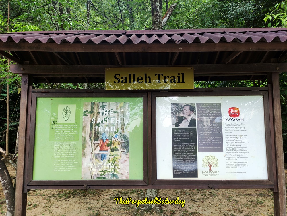
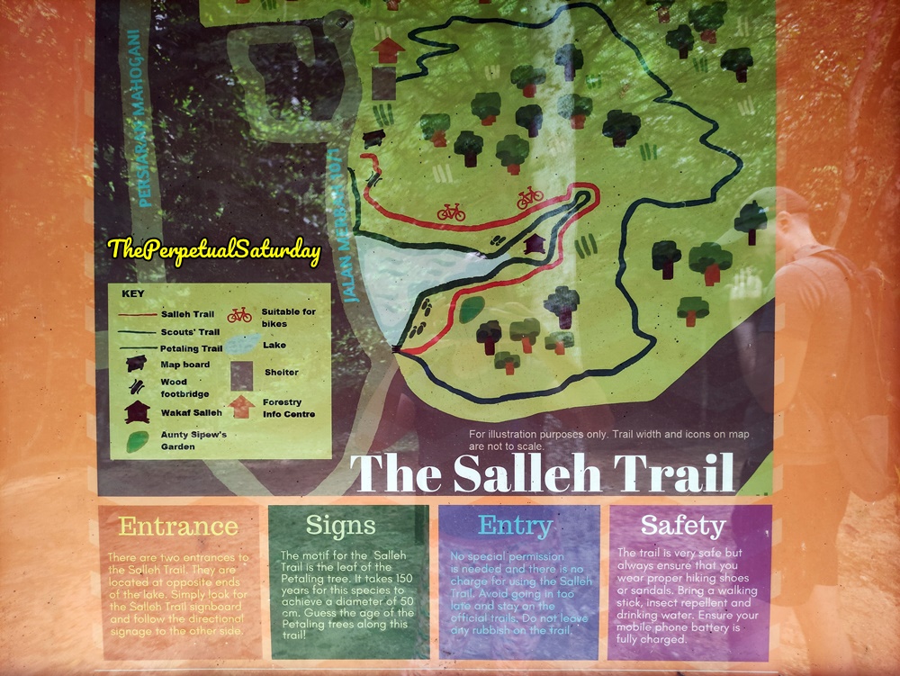
First, you’ll come to an information board. One side showcases the history of the trail. The reverse side includes more useful information, such as a map with points of interest. Notice how this map shows the trails marked correctly with Salleh on top and Petaling on the bottom.
The Salleh Trail is not a circuit, so a round trip might take up to an hour if you simply walk to the end and come back. However, Salleh joins with the Petaling and Scout Trails, which you can take for a route back to the Forestry Information Centre. We combined Salleh and Petaling for a short lakeside hiking loop.
Salleh Trail Starting Point
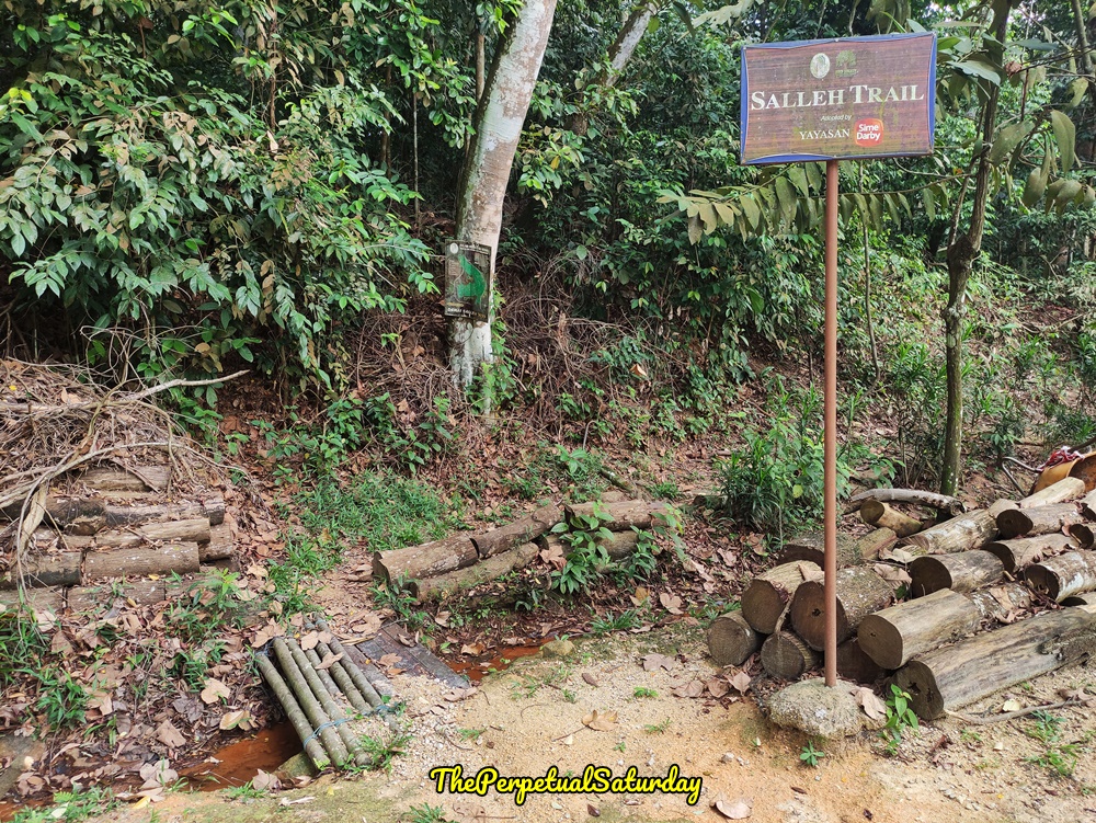
The Salleh Trail entrance is a few steps from the information board, marked with a tall sign. You can also do the Petaling Trail first and take the Salleh Trail back. In that case, don’t cross the small stream and walk a little further. Check out my Petaling Trail article below for specific directions.
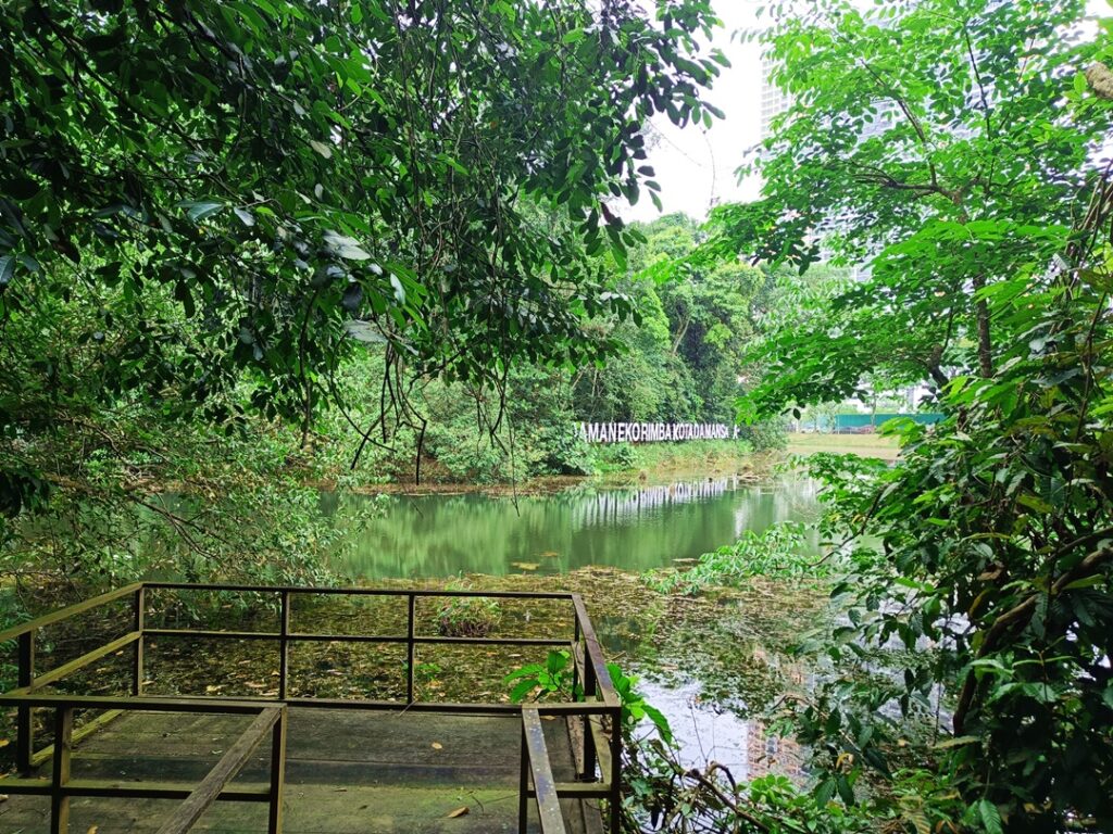
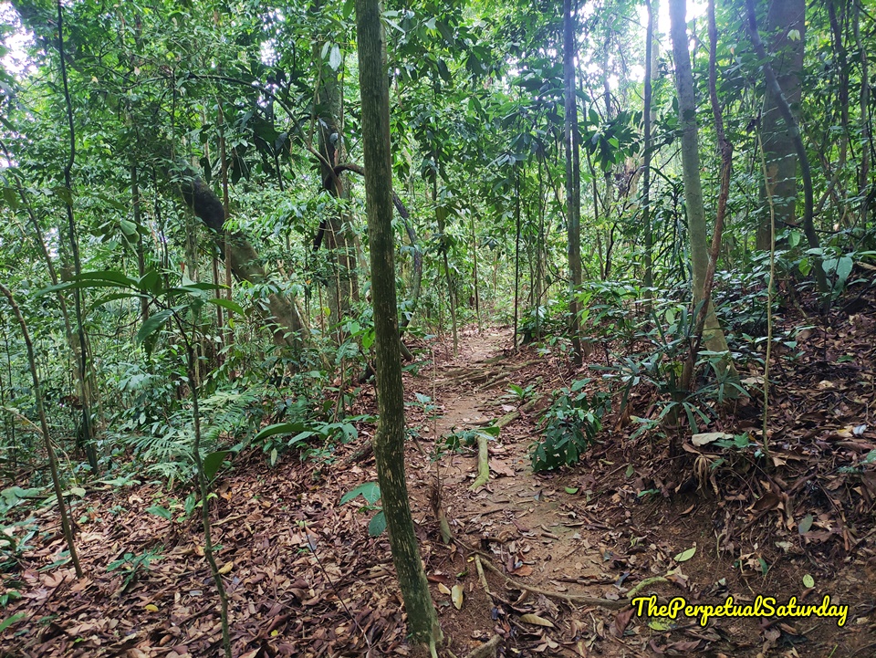
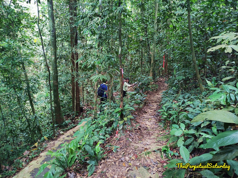
Once on Salleh, the narrow path runs along the rivulet for a while before curving into the forest. You may notice a second path closer to the lake that runs adjacent to Salleh. This is the Petaling route. In certain spots, it’s close enough to switch trails easily if you wanted to. If you want a direct way to a viewing platform of the lake, then the Petaling Trail is the one you want.
Even though the Salleh Trail is longer, it’s easier than the Petaling Trail. Both are simple hikes, but Petaling has a very slight incline and decline. Petaling also has a paved path that gets slippery at certain points. Since the Salleh Trail is suitable for bikes, it is very flat and smooth. There are no stairs anywhere along the route.
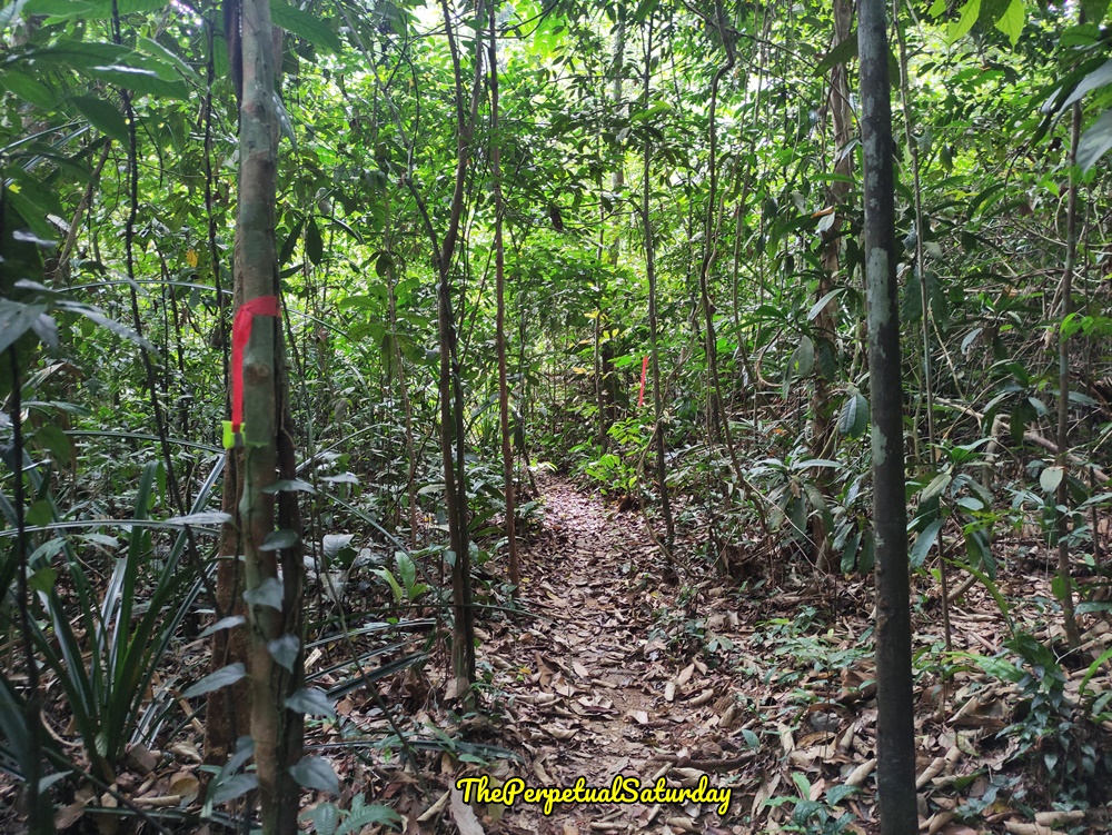
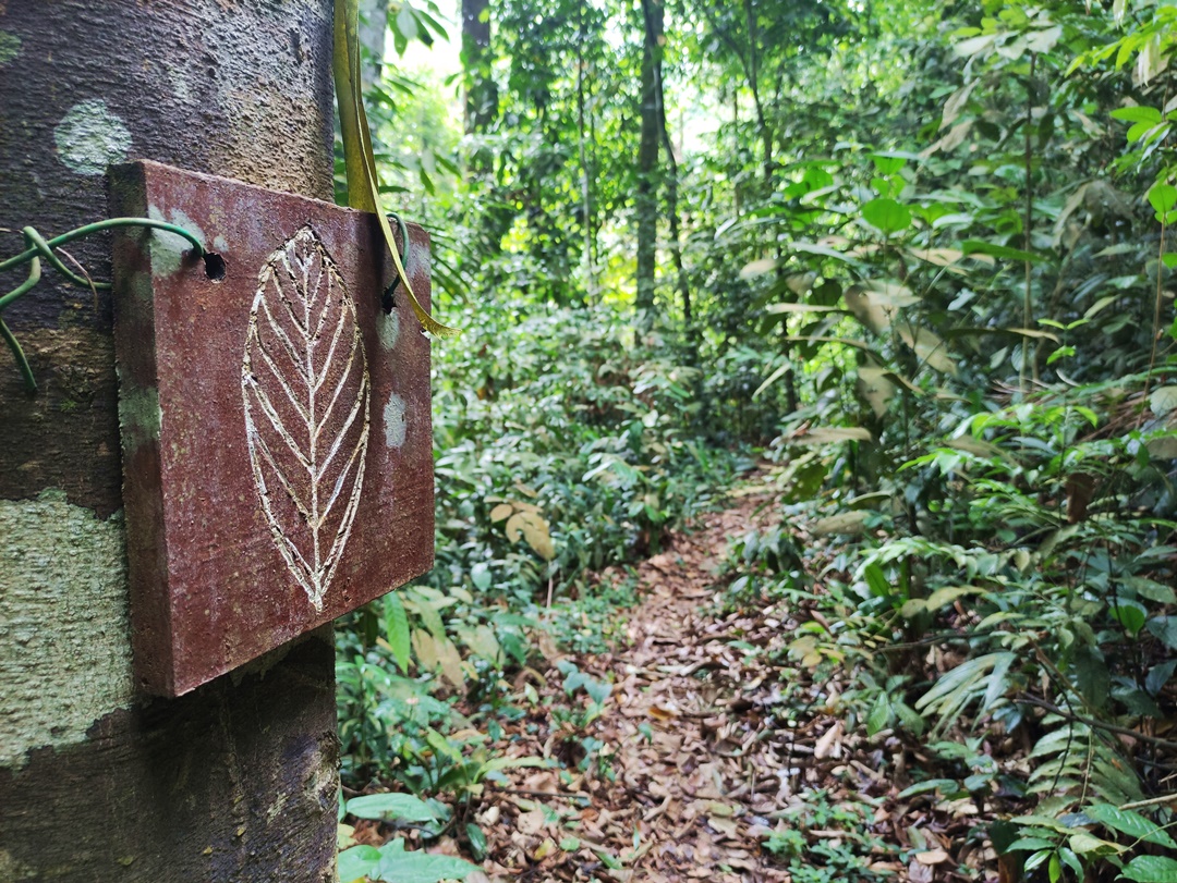
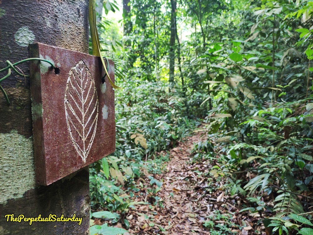
The Salleh Trail is well-marked with neon green tags dangling from red ribbons hanging from branches. Sometimes you’ll also see a wooden block with a leaf carved into it attached to tree trunks. Both serve to mark the trail.
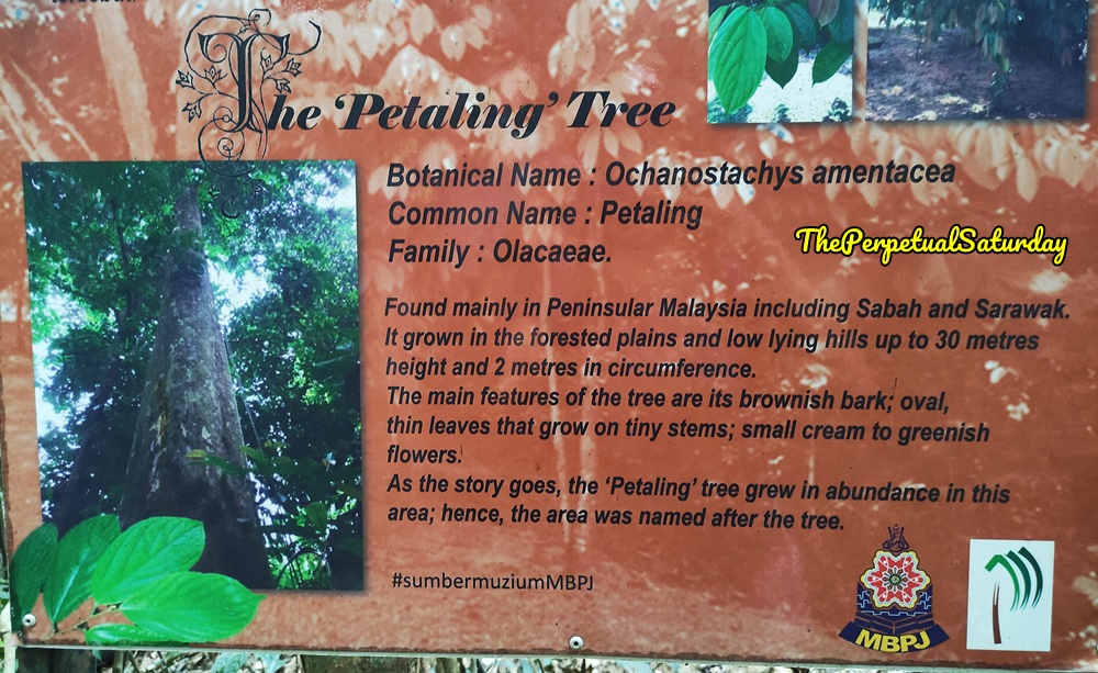
You’re nearly done with the hike once you reach the Petaling Tree. If you head to the right after the information board in the picture above, there is a dirt path that connects to the end point of the Petaling Trail. Then you can walk along the lakeside to eventually make your way back to the Salleh Trail start point and the Forestry Information Centre. Otherwise, you will join up with the end of the Scout Trail.
Saturday Worthy?
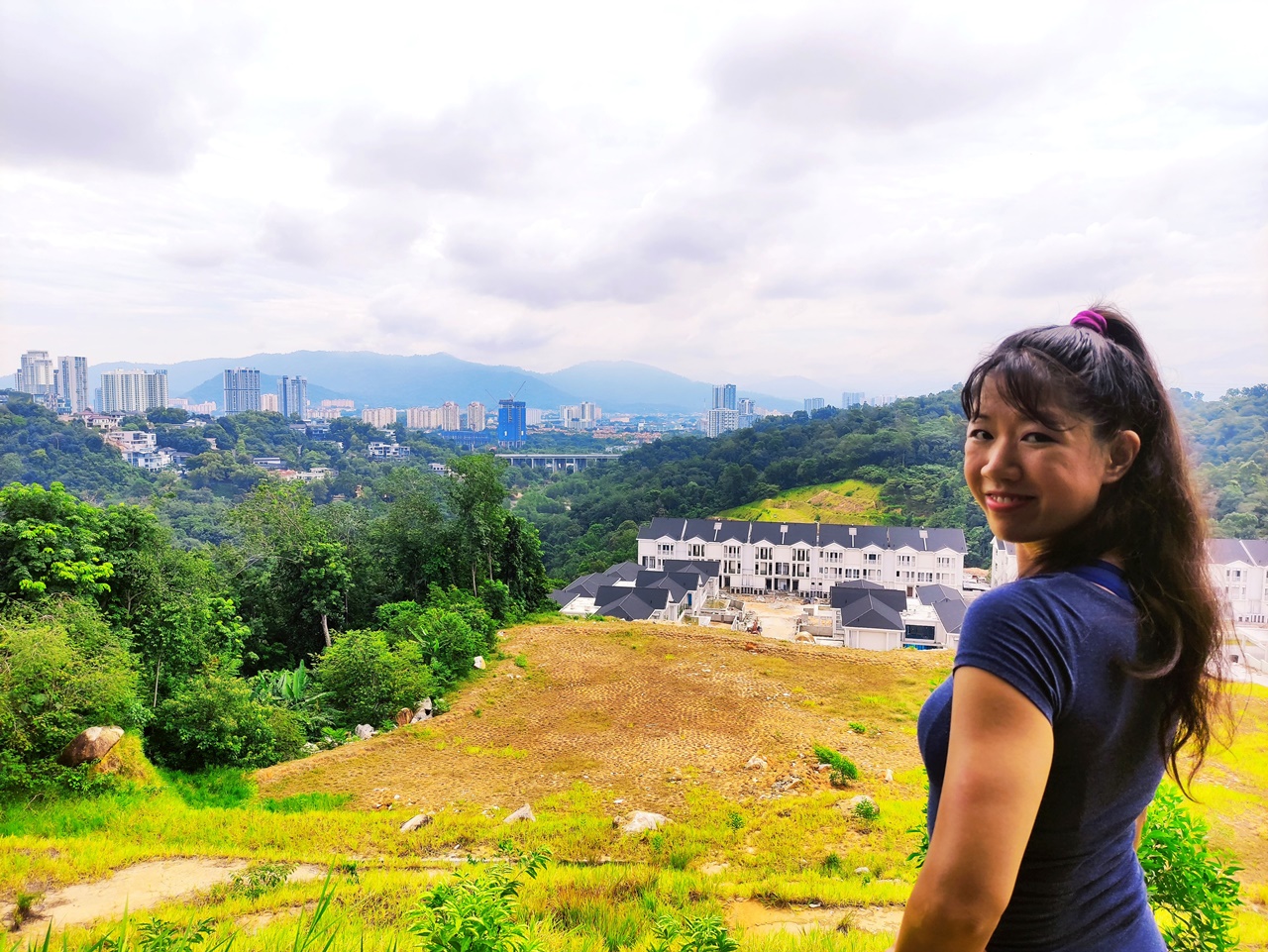
I can’t see a situation where the Salleh Trail is the main (or only) hike you do at the Kota Damansara Community Forest. It’s too short, and the Petaling Trail has better lake views if that’s what you’re after. I recommend using Salleh to form a hiking loop with other one-way trails such as Scout or Petaling. Alternatively, it can act as a gentle start or end for the other challenging routes toward Unity Peak.
Kota Damansara Forest Reserve Salleh Trail Info
Duration: ~30 min (one way)
Difficulty: Easy
Opening Hours: Weekends & Public Holidays 7:30 AM – 2 PM, Monday to Thursday 8 AM – 2 PM, Friday 8 AM – 1 PM
Parking: Yes (free street parking)
Washrooms On-Site: Yes, at Forestry Information Centre