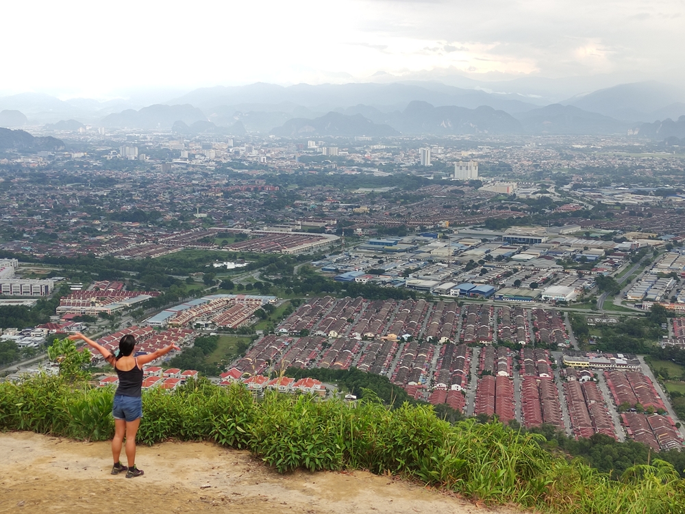
Bukit Kledang is a well-loved hiking spot for the residents of Ipoh, evidenced by how clean they keep the trails. Not far from central Ipoh, this is an easily accessible location with paths that are well-maintained and easy to follow. All of Bukit Kledang’s hiking trails are totally free. There aren’t even any parking fees that you’ll have to pay.
This post will delve into what to expect when hiking to the Kledang Hill viewpoint, also known as the “4-2” trail. Note that the viewpoint is not the summit. Bukit Kledang rises to 808 metres at its summit and takes four hours or more to get to. Many just do the trail to the viewpoint which sits at 350 metres. Though this sounds like a low elevation compared to the summit, this viewpoint has the clearest, unobstructed vista of Perak below. The summit is swarmed with trees and you won’t be able to see anything up there.

We took a Grab and had no trouble getting a driver to take us here since Bukit Kledang isn’t far from Ipoh’s suburbs. Do the courteous thing and be prepared to be let out slightly before the drop-off point as it can get increasingly difficult for the car to turn around as you drive in deeper. Take note that phone reception can be bad at the base of Kledang Hill. While getting a Grab driver afterwards to take you back to the city should be no problem, you might have a hard time getting data to connect to Grab in the first place.

Begin the trail at the parking lot. The first bit is walking on paved concrete. On your left will be this obvious offshoot to begin the viewpoint trail properly. I didn’t see any food or drink vendors in the parking lot, so make sure to bring provisions. A one hour hike may not sound like much, but I guarantee you’ll be sweating buckets!
There is the option to continue on this paved road all the way to the viewpoint and beyond. This road is a much longer, winding route with a moderate incline. Hiking up a car road is pretty boring, but this path is an option for the way down if you’re tired. If you need to empty your bladder urgently, there is a toilet shack a little up the road. Don’t expect any niceties – the toilets are all squatters with no toilet paper or sinks to wash up at.
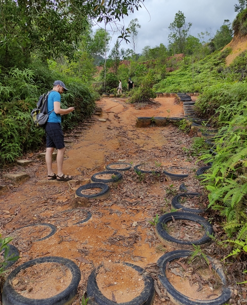
You’ll know you’re on the correct 4-2 trail right away if you spot this tire path. The way to the Bukit Kledang viewpoint is a well-trodden hiking trail, and you’ll encounter many locals of all fitness levels getting their exercise here. This hike can be an utter killer if you’re out of shape. There was one guy of normal size who was keeping pace with us, wheezing heavily. I lost him after we took a long photo break at one of the checkpoints but I saw him later, totally collapsed on a rock just below the viewpoint. Even if you’re fit, the Bukit Kledang hike is still a worthwhile challenge. There were a lot of shirtless old dudes on the trail getting their workout that had good physiques for men of their age.
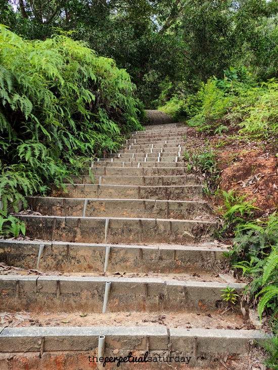
The trail begins very wide and relatively flat with man-made stairs hugging the rock face. After you go around the bend, the path narrows until all you see before you are stairs, stairs and more stairs going until infinity. This can be a long slog but the stairs here are still wide enough for you to stand off to the side to take a breather without getting in anyone’s way.

It is about ten to fifteen minutes of upward trudging to the landmark, the communication tower station. At the top of the stairs, the path intersects with the car road.

There is a gazebo where you can rest before continuing up these stairs directly across the road. If at this point you need a toilet, walk a little down the car road and there will be another toilet shack next to a shelter there. There is no toilet at the viewpoint, so this will be your last chance to go.
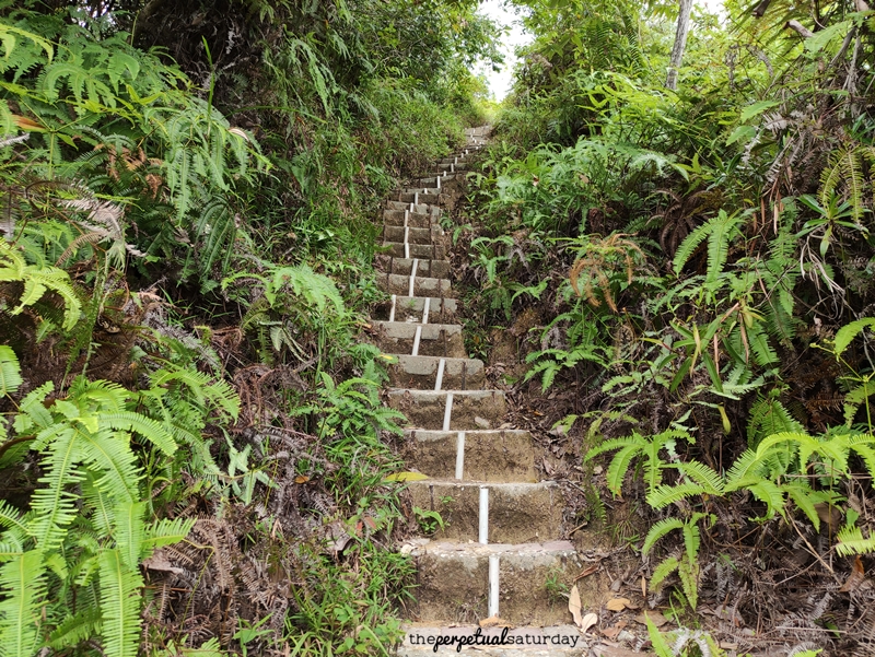
The journey to the next checkpoint is shorter, less than five minutes if you don’t stop, but these stairs are much steeper. They’re also narrow, barely enough to fit one person. If you’re not confident that you can make it up these stairs in one go, wait until you’re sure that you will be the only one on the trail. If you have to take a rest while on the stairs, you’ll be holding up everyone else behind you and it will be hard for them to manoeuvre around to pass you. Not to mention that you will be very sweaty and stinky at this point, and they will all be downwind of you.
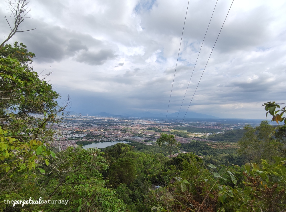
You’ll begin to see a hint of the amazing view that awaits once you clear the treeline and turn around. At the top of these steep stairs is the car road again and another gazebo where you can admire the landscape.
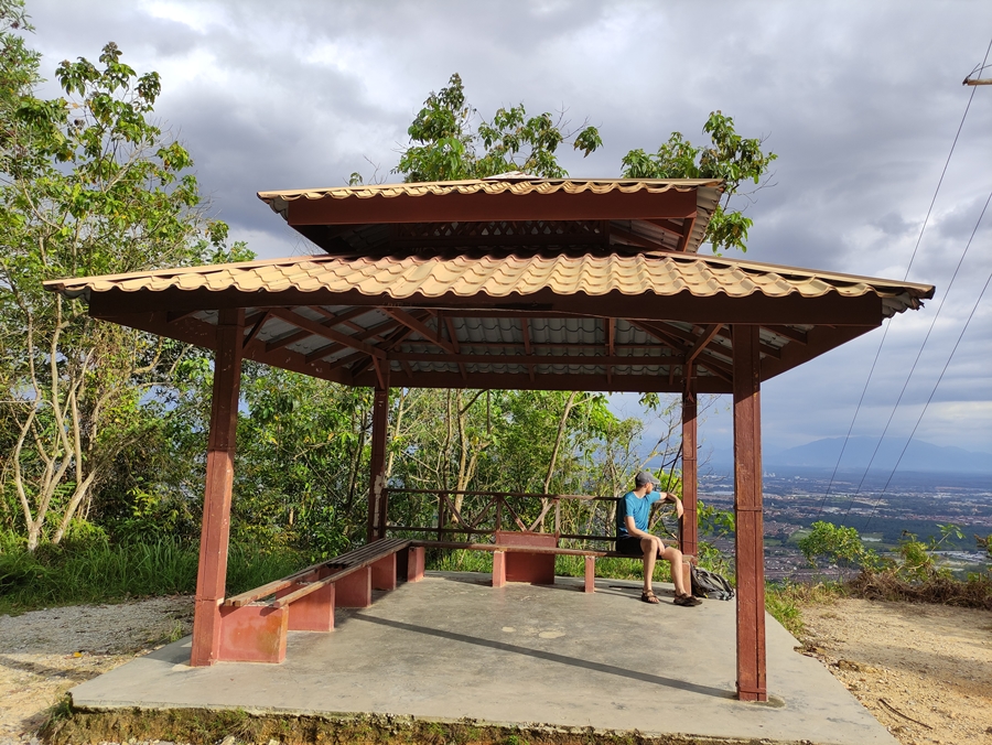
While this view is impressive, there are still some trees and power lines in the way so don’t spend hours here because there’s an even better view ahead.
The next part of the trail similarly begins across the street with these stairs, much more roughly hewn than the last set.
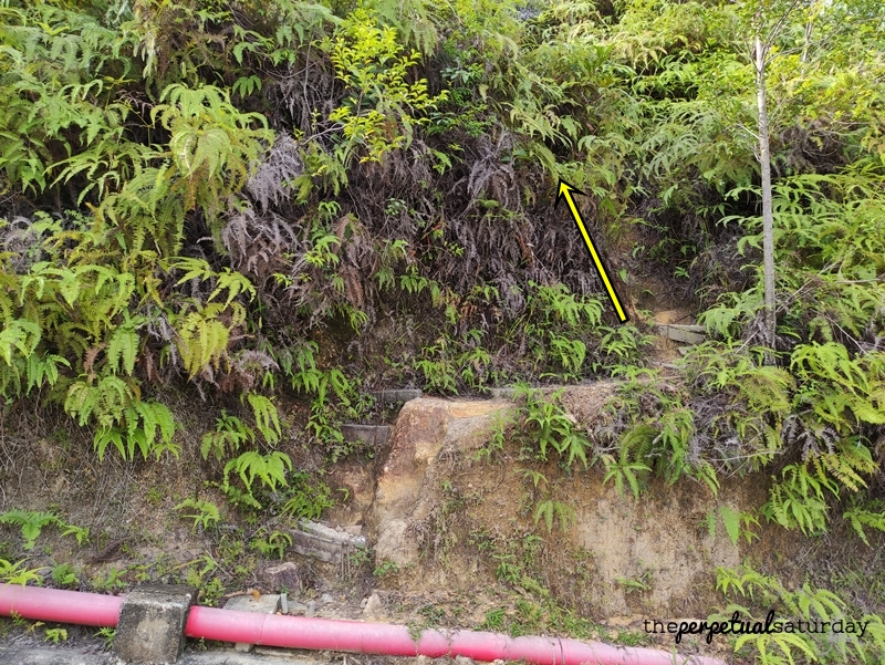
Very quickly, the stair blocks disappear and it’s just a dried mud path upward. It’s steep at times, and the dirt can be loose so you’ll need to be more careful here. This stretch of the trail will take about five to ten minutes to clear.

The top of this climb rewards you with another nice view, but you are not at the best one yet.

The set of stairs across the road marks the final ascent to the viewpoint. However, we took the road for the rest of the way because someone was too tired (pardon my bitterness).

If you want to take the same route we did, turn right on the car path. Walk past a couple of gazebos and take this shiny, new-looking staircase that will be on your left. This roundabout way took only five minutes. I would guess that the direct way up the dirt trail takes slightly less time, but requires much more effort.

At the top of these final stairs, there is a shelter. There is no view from this spot and it is just a place to rest. To get the to overlook, walk past the outdoor gym equipment and where someone has patriotically strung up a Malaysian flag on a stick.

The viewpoint has a wide, spacious landing where many hikers can admire the breathtaking scenery. If you’re lucky enough to be the only one here, you can get a cool panorama. This spot is completely above the treeline, so there’s nothing to block your view. It’s not a 360-degree view as the hill is in the way, but even on a cloudy day like this, we could see far ahead into the distance.

Sit and stare for as long as you please – there’s room enough for everybody even with social distancing! When you’re rested and your eyeballs are satiated, choose your path back to the base of Bukit Kledang: either backtracking on the trail or taking the car road down. Most of the other hikers seemed to take the paved road at least until the comm tower before taking the wide staircase down on the proper trail. The dirt trails before then are too narrow for you to safely pass if you encounter another hiker ascending them at the same time. If you are continuing on the car road past the comm tower, remember that two toilet shacks are coming up if you need to go.
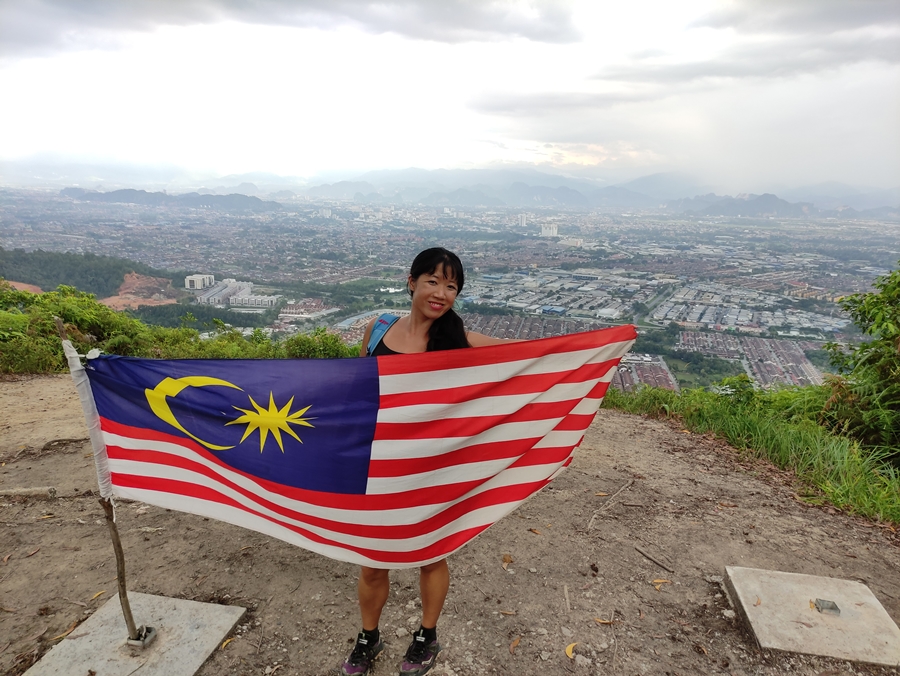
We had a fun afternoon hiking Bukit Kledang. Not only is it easy to get to, but there is a variety of challenging yet clear trails that one can do again and again. One day, we hope to tackle the summit, and there was also a trail that seemed to lead to secluded overlook that we’d like to try. We already know that we will return to Kledang Hill on one of our future getaways to Ipoh. If only KL had a hill trail that was this clean, organised and challenging!
Trail Info
Address: Jalan Kledang, 31450 Ipoh, Perak
Opening Hours: Open 24 hours
Duration: Approximately 1 hour to viewpoint, 2.5 hours+ roundtrip
Parking: Yes (free)
Washroom On Site: Yes



Hi! I have a question – do you need a permit to hike in Perak please?
I’m not sure about the other sites, but there was a big pushback when the gov tried to implement a hefty permit fee to hike Bukit Kledang. They postponed the fee until further notice and there’s no news of whether it was put into effect. Permits usually apply for “gunungs” (mountains) around Malaysia if that’s where you plan to go.